A Quiet Rural Locality Defined by Rail and Water
Region: South West
LGA: Harvey
Industry: Rail Transport
Other Name/s : Bila, Beela Railway Siding, Bila Railway Siding, Beela Dam
Meaning of Name: Place where the river water is running into a pool.
Open Street Map: -33.23614281710022, 115.89862701061266
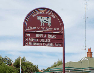
What3Words: ///husbands.staircase.occupational
Settled: 1839 (region settled), 1912 (Railway Siding)
Gazetted: N/A
Abandoned: 1988 (Railway), 2004 (Dam)
History
Beela, a quiet rural locality nestled in the South West of Western Australia within the Shire of Harvey, is situated immediately east of Brunswick Junction. Historically known as Bila, the name is derived from the local Noongar language, meaning “there in that place is where the river water is running into a pool”. Today, Beela is formally recognized as a small community, with a recorded population of 56 in 2021. Its identity has been shaped by its agricultural environment and key infrastructure: a vital railway stop and a former regional water source.1
Establishment and Context of the Railway Siding
Community and Infrastructure

The broader railway line connecting Brunswick Junction to Narrogin commenced construction in 1898 and was officially opened on October 7, 1907. Beela’s specific role began soon after, catering to the growing needs of the farming community. The railway station, originally designated Bila, began operation on June 25, 1912, as an automatic Electric Staff (ES) station. Its establishment was critical, as it functioned by splitting the railway section between Brunswick Junction and Lunnenberg (Collie).2
The surrounding community was fundamentally agricultural, specializing in livestock and farming. Evidence of this usage is drawn from records dating to 1962, which list several property holders associated with livestock brands tied directly to “Beela Siding” or “Beela”.
These operators included Denham C. (jnr.) of Tipperary, Beela Siding; F. Ratcliffe of Crystal Valley, Block No. 2664, Worslee and Beela; V. R. Sales of Hillsbrook, Beela, via Brunswick Junction; J. & R. L. Straw & Whiteaker of Blue Valley, Beela; and J. G. & P. M. Waters associated with Kooweerup, Lot 67, Burekup and Beela.3
Operational instructions for the siding were precise and were updated after the name changed from Bila to Beela, sometime before 1944. New general instructions issued in 1944 mandated specific crossing procedures to enhance safety: down trains were directed to take the main line, and up trains were directed to use the loop. This arrangement was implemented to allow a better line of sight for the drivers and guards of the down trains.4
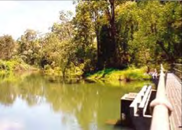
A separate, critical piece of infrastructure in the locality’s history was the Beela Dam, which was built in 1938 to provide the nearby community of Brunswick Junction with drinking water.5
Closure and Legacy
While the railway network saw changes, the core operation of the siding persists. The Brunswick Junction to Narrogin railway line was partially closed in 1988, but the section running through Beela, connecting Brunswick Junction to Collie, remains an operational stop. The major infrastructure closure in the locality was the eventual decommissioning of the Beela Dam in 2004. This action was taken due to growing concerns about water quality and the security of the water supply.6 7
Beela continues as a small rural locality. Although the dam facility is closed, and the community is small, Beela retains its original character, described as a tranquil area with an enduring agricultural heritage.
Timeline
- 1898 – Construction commenced on the Brunswick Junction to Narrogin railway line.
- 1907, October 7 – Brunswick Junction to Narrogin railway line officially opened.
- 1912, June 25 – The locality opened as an automatic Electric Staff station named Bila, splitting the Brunswick Junction–Lunnenberg (Collie) railway section.
- 1938 – The Beela Dam was constructed to supply drinking water to Brunswick Junction.
- 1944 – Operational instructions referred to the station as Beela, requiring down trains to use the main line and up trains to use the loop when crossing.
- 1962 – Several property holders were recorded operating livestock brands associated with Beela Siding or Beela, confirming its role as an agricultural hub.
- 1988 – The wider Brunswick Junction to Narrogin railway line saw partial closure.
- 2004 – The Beela Dam was decommissioned due to concerns over water quality and supply security.
- 2021 – Population of the Beela locality recorded as 56 residents.
Stories
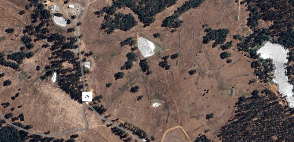
- Beela Dam: Located 10Km upstream of Brunswick Junction, the 4m high Beela Dam was the primary water source for the Brunswick Junction Regional Water Supply Scheme, which supplied the communities of Brunswick Junction, Burekup and Roelands. The catchment for the dam is approximately 132Km2. In the summer of 2001/2002, water levels in the reservoir were severely affected by drought. The Water Corporation decommissioned the dam in 2004 due to water quality and security of supply issues caused by insufficient stream flows.8
Map
Sources
- Wikipedia, 2025. Beela, Western Australia. Retrieved 1 Dec 2025 from https://en.wikipedia.org/wiki/Beela,_Western_Australia ↩︎
- Wikipedia, 2025. Brunswick Junction to Narrogin railway line. Including image of Route Map. Retrieved 1 Dec 2025 from https://en.wikipedia.org/wiki/Brunswick_Junction_to_Narrogin_railway_line ↩︎
- Carnamah Historical Society & Museum, n.d. WA Livestock Brands 1912-1962. Retrieved 1 Dec 2025 from https://www.carnamah.com.au/livestock-brands?keyword=Bila ↩︎
- Hopper, Peter, n.d. Summary of WAGR Weekly Notices Volume 1 1896-1920. Page 1912.4. Retrieved 1 Dec 2025 from https://www.railheritagewa.org.au/info/files/WAGR_WN_Summary_Hopper_1896-1970.pdf ↩︎
- Wikipedia, Beela: Refers to the building and decommissioning of the Beela Dam ↩︎
- ibid. ↩︎
- Wikipedia, Brunswick Railway: Refers to the partial closure of the line in 1988 ↩︎
- Beckwith Environmental Planning Pty Ltd, 2006. Brunswick River – Surface Water Management : Issue Scoping Report. Retrieved 25 Nov 2025 from https://www.wa.gov.au/system/files/2022-11/Brunswick-River-Surface-water-management-Issues-scoping-report.pdf ↩︎
- Beela, 2025. Aerial Image. Retrieved 1 Dec 2025 from https://what3words.com/husbands.staircase.occupational ↩︎
Further Reading
- State Records Office of Western Australia
- Australind Heritage Trail
- Boodjar: Nyungar Placenames in the South-West of Western Australia
- Wiki Australia: Guide to Beela
- Rail Heritage WA Archive Photo Gallery
- Annual Report of the Department of Mines for the year 1920
| Last Updated: | 7 Dec 2025 |
