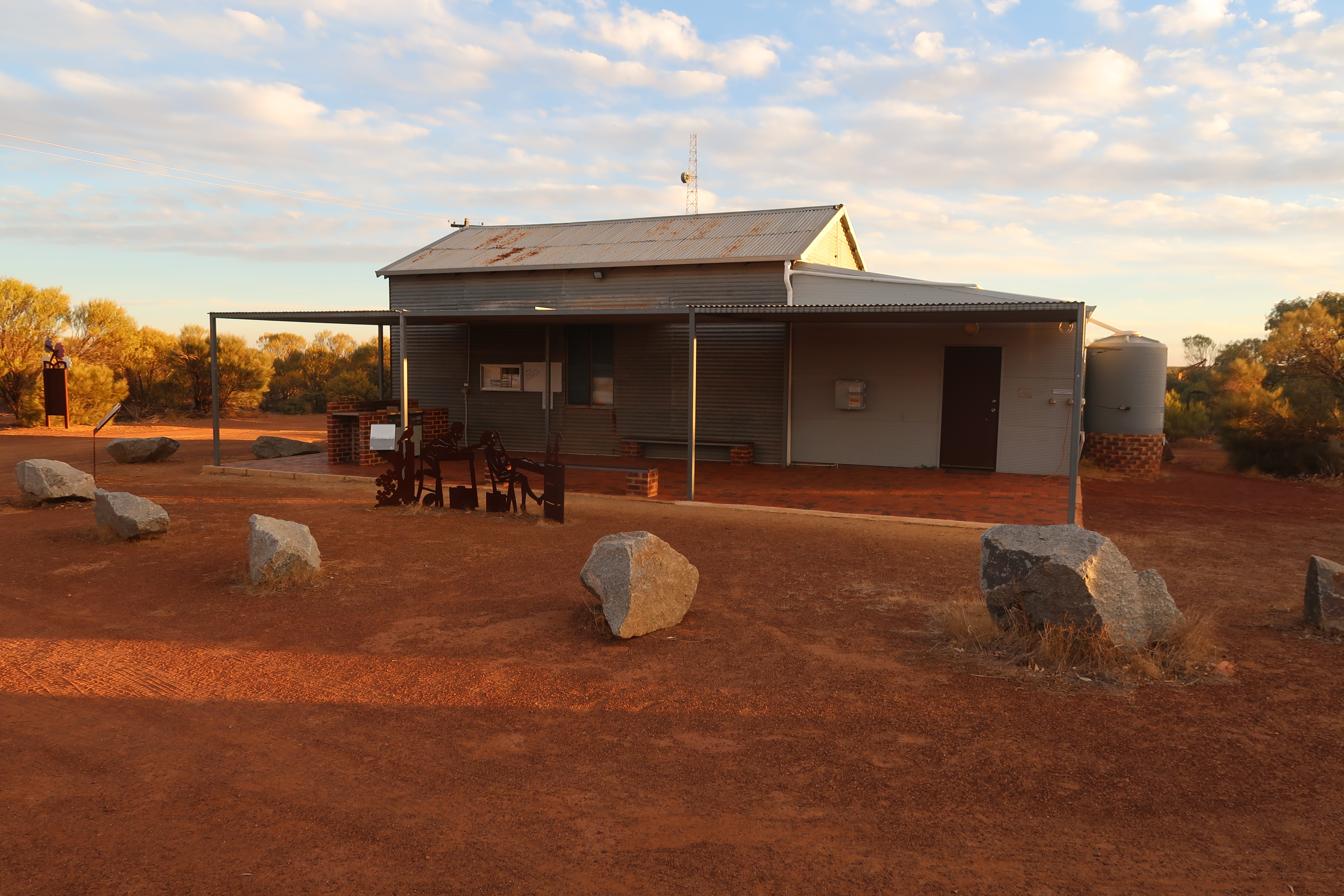
Christine Harris (Aug 2026)
Demographics
Region: Mid West
LGA: Morawa
Industry: Railway Siding & Agriculture
Other Names: Pindawa, Canna Railway Siding
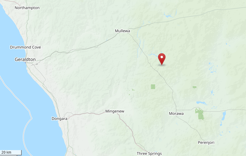
Open Street Map: -28.81879096398886, 115.87426246523307
What3Words: ///partly.prodding.broadens
Settled: 1914
Gazetted: 1928
Abandoned: About 1952
Abstract
This article provides a detailed historical account of Canna, a small settlement in the Mid West region of Western Australia, also known in its early years as the Canna Railway Siding and Pindawa. The narrative focuses on the first half of the twentieth century, beginning with the 1913 proposal by the Public Works Department to establish a siding on the Wongan Hills to Mullewa Railway line. It details the political and administrative decision to change the name from Pindawa to Canna in 1914 to prevent confusion with the nearby town of Pindar.
The article explores the environmental foundations of the town, specifically the reliance on Koolanooka Springs and the construction of railway dams to support steam locomotives. The town’s commercial development is traced through the 1928 gazettal and the 1929 opening of the Canna Pioneer Store, which remained a community staple for over seventy years. Social resilience is highlighted through anecdotes of the Great Depression, such as the 1931 hardtimes dance at Pindawa woolshed, and the 1935 construction of the Canna Hall. Significant attention is given to the Lutheran community, whose members hand-pressed 22,000 bricks to build the Trinity Church in 1955. Genealogical insights are provided through the livestock brands and school records of pioneer families like the Mickes and Kowalds. Finally, the article reflects on Canna’s modern identity as a renowned destination for wildflower enthusiasts and campers, sustained by the dedication of local residents.
History
The vast agricultural landscape of Western Australia’s Wheatbelt is punctuated by small towns that serve as monuments to the ambition of the early twentieth century. Among these is Canna, a community located approximately 401 kilometres north of Perth and 43 kilometres north east of Morawa. While today it is perhaps best known for its vibrant seasonal flora, its origins are deeply rooted in the expansion of the state’s railway network and the grit of pioneers who sought to turn semi-arid scrub into productive farmland. The history of Canna, also known through its variants as the Canna Railway Siding and Pindawa, is a story of environmental adaptation, social cohesion, and economic endurance.
The Iron Road and the Selection of a Site
The formal history of the community began with the surveyors and engineers of the Public Works Department. Early in 1913, as the Wongan Hills to Mullewa Railway was under construction, a site was selected for a siding at the 51 mile, 2 chain peg. The settlement’s existence was a direct consequence of the political pressure applied in 1911 by a deputation from the Morawa district, who pressed the State Premier for the construction of a line to service the northern wheat districts. The arrival of the railway was viewed as the essential prerequisite for any large scale agricultural selection in this semi arid environment.1
A Question of Identity – From Pindawa to Canna
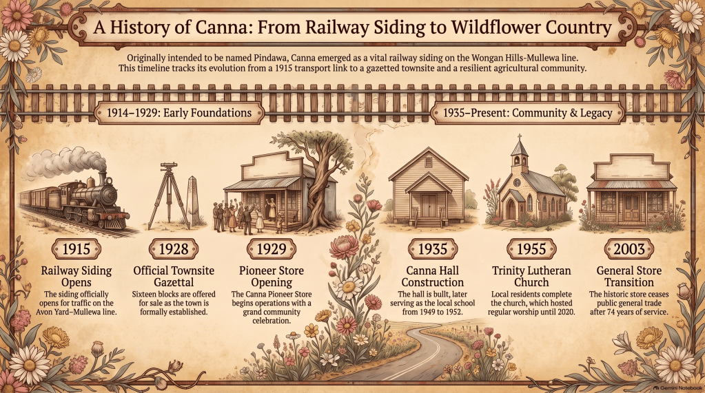
The authorities initially settled on the name Pindawa, which was derived from the Aboriginal name for a well situated about eight kilometres to the west of the proposed siding. Records from 1913 show that when the land was first set aside for a future townsite, the spelling was even recorded as Pinndawa. However, the naming of the town quickly became a point of administrative concern for the railway and postal departments. In 1914, the name Pindawa was declared unsuitable because of its phonetic and orthographic similarity to Pindar, another station on the same line. To prevent postal and logistical errors, alternatives were requested. The name Yondong, an Aboriginal word for the black goanna, was proposed alongside Canna. Although Canna is the name of a Scottish island and a genus of flowering plants, historians suggest its choice here likely had an Aboriginal origin, possibly being a derivative of the Wongi word Kana, meaning green or alive. The name Canna was officially adopted in June 1914, and when the railway line opened for traffic on 5 April 1915, Canna took its place on the map as a recognised stopping place.2
Environmental Realities and Aboriginal Foundations
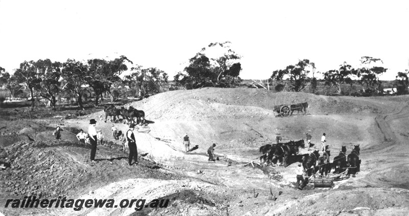
The environment of the district dictated the terms of survival for the early settlers. Situated at an elevation of 342 metres, the area receives an average rainfall of roughly 250mm, making water the most precious and defining commodity. Long before European arrival, the local Aboriginal groups had utilised the Koolanooka Springs as a permanent water source and a place for meetings and hunting over many generations. For the European pastoralists who arrived around 1909, these springs were equally vital, providing the fresh water necessary to establish the first agricultural selections. The railway department recognised this environmental reality by constructing substantial dams at the siding to service the steam locomotives that were the lifeblood of the region early economy. These dams, along with a heavy duty railway crane, remain as some of the few tangible links to the town initial 1915 railway origins.3 4
The Birth of a Township
For more than a decade after the railway arrival, Canna remained a collection of scattered agricultural selections rather than a concentrated townsite. This changed in 1928 when the townsite was formally gazetted and sixteen blocks of land on the east side of the railway line were offered for sale. This political act of gazettal provided the legal framework for commercial growth, the most significant result of which was the establishment of the Canna Pioneer Store. Opening its doors on 27 April 1929, the store debut was a major social milestone for the district. The grand opening featured a performance by the Gutha, Canna brass band, drawing families from across the northern wheatbelt. The store was much more than a commercial enterprise; it served as a post office and a central node for social interaction in an era before easy motor transport. It became an institution of remarkable longevity, operating continuously for seventy four years until it ceased general merchant operations in 2003. Today, the old store is a popular site for visitors, famous for the unique quirk of a large tree growing directly through one of its walls.6
The early 1930s brought the dual challenges of the Great Depression and the struggle to establish a sense of community identity. Despite the severe economic downturn, the social fabric of the district was maintained through communal effort and creative fundraising. On 24 October 1931, a notable social evening was held in the Pindawa woolshed. A large crowd attended a hardtimes costume dance, an event designed specifically to raise funds for the local brass band. In a charming glimpse into the genealogical records of the time, Mr Harold Micke and Miss Hilda Micke were recorded as the prize winners of the evening. Such gatherings were common during this period, reflecting a population that refused to let financial hardship dampen their community spirit. This era of cooperation culminated in 1935 with the construction of the Canna Hall. Designed by local figures Anne Harman and Norm Harris, the hall was a simple but sturdy rectangular wood framed building clad in corrugated iron. For generations, it would serve as the primary venue for dances, meetings, and celebrations, embodying the town collective life.
Trinity Lutheran Church
Genealogists and local historians find a wealth of information in the records of the families who settled the Canna district. The Micke family, of German heritage with strong earlier ties to South Australia, were among the most prominent figures in the town development. Friederich, known widely as Bill, Micke was a leading early settler whose commitment to his faith would leave a permanent mark on the townsite. As early as 1930, there was enough interest among the local families to invite Lutheran pastors to conduct services in private homes. These domestic gatherings eventually outgrew their surroundings, leading to services being held in the Canna Hall. On 11 November 1949, a new Lutheran congregation was formally established specifically at Canna.7
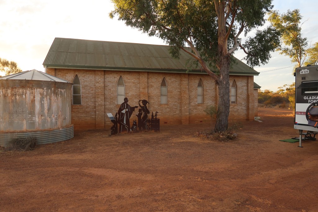
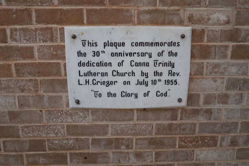
The dedication of the Lutheran congregation reached its peak in the mid 1950s. On 10 July 1955, the Trinity Lutheran Church was dedicated in the townsite. The construction of this church is a remarkable example of bush ingenuity and manual labour. Approximately 22,000 cement bricks were made by hand on a press at the Pindawa Homestead, which was the property of the Micke family. The foundations were laid during a community busy bee, and local tradesmen donated their time and labour to complete the structure. The church became a cornerstone of spiritual life, hosting its first wedding in 1959 for Gloria Kowald and Roy Micke. It remained a place of worship for local residents until 2020, eventually being sold into private ownership in 2021.
Pioneer Families
The demographic and genealogical history of Canna is further enriched by records of other pioneer families who registered livestock brands and established properties in the district. In the 1920s, families such as the Basfords, including Thomas R. Basford and Myrtle and J. K. Basford, were active at Canna Siding. Walter Brown held Victoria Locations 7549 and 6235, while Reg. A. Nicholas established South Downs. By the early 1960s, a new generation of families was firmly established, including G. and L. Croot at Warraminni, G. N. Crowden at Glen View, and H. A. Fabling at Colganatta. The Kowald family was particularly active, with G. O. Kowald managing the Mugga Wagga property and R. J. Kowald at Pindawa. Other names that appear in the annals of Canna’s agricultural history include the Heitmans of Nanekine and Indar, the Lanagans of Glenhelen and Legomery, and the Wiltons of Moon Bi.9
The lives of individual residents provide a poignant look at the human experience in the bush. Frank Ewin Macklin is perhaps the most well known of Canna’s more solitary figures. Macklin was an English serviceman who had suffered the profound tragedy of losing his wife and child during air strikes in the First World War. Seeking a new beginning, he moved to Western Australia and worked as a farmhand and eventually as a pumper at the railway dam.
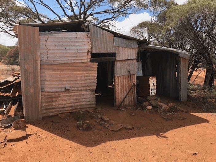
Upon his retirement around 1950, he built a humble shack known as the Old Camp, where he lived for many years with his dogs. Macklin passed away in 1968 at the age of 85 and was buried in the Morawa cemetery. The ruins of his small hut, which offered almost no basic comforts, serve as a stark reminder of the physical hardships and the isolation that characterized life for many in the Mid West.10
Education was another vital concern for the growing pioneer community. In the late 1930s and 1940s, several assisted schools operated in the wider district to serve the children of the various agricultural selections. Canna East was one such school, where teachers like Vida Northwood (1938), Esme Doherty (1939), and Ida Palmer (1946 to 1948) provided primary instruction. For the children living closer to the siding, the Canna townsite school was run directly from the Canna Hall between 1947 and 1952. Other educators associated with the town included Matthew Scouler, who served as a head teacher on probation in the early 1950s, and sewing mistresses such as Erva Micke and Esther Skipworth. These schools were more than places of learning; they were essential social centres where children from isolated farms could interact and form lifelong bonds.11
The Economic Lifeblood – Wheat and Bulk Handling
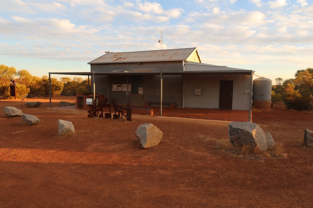
The economic foundation of Canna has always been wheat farming. The town landscape is dominated by a massive wheat silo and loading facility, which marks its status as a grain receival point for the Co operative Bulk Handling group, or CBH. CBH was created in 1933, marking a major technological and economic shift from transporting grain in heavy bags to bulk operations. Life in Canna was largely determined by the harvest cycle. Local news columns, often published under titles like Canna Comments, provide a vivid record of this agricultural life. In September 1950, reports noted the loading of cattle at the railway stockyards by Frank Lanagan and Bert Croot, an activity that was already becoming rare as road transport began to eclipse the rails. The same column recorded the departure of Allan Mutch, who reportedly left the town on a diesel train after tiring of the district. In 1953, reports described the arrival of a strange contraption known as the Midget Octopus Weed Burner, a railway maintenance vehicle equipped with tanks and spouts designed to scorch weeds from the tracks. These accounts, while simple, provide a genealogical and social map of the residents and their daily labours.13
The Seasonal Spectacle of Wildflower Country
Environmental factors have influenced Canna history in ways that extend beyond water scarcity and agriculture. The town is situated in the heart of what is colloquially known as wildflower country. Every spring, the surrounding bush and the Canna Reserve are transformed by seasonal rainfall into a spectacular display of colour. From August to October, the area attracts visitors from across the country who come to see fields of everlastings, native orchids like the Donkey Orchid, and the rare, much sought after wreath flowers. Local residents, most notably Paul and Sue Offszanka, have spent decades cultivating an extensive knowledge of these displays, guiding tourists along the walking trails that wind through the district. This natural heritage has provided Canna with a secondary purpose and a source of community pride even as its role as a bustling railway hub declined in the latter half of the twentieth century.14 15
Preserving the Past for Future Generations
The social and historical importance of Canna is today preserved through various heritage listings. The Canna Pioneer Store, the Canna Hall, and the Trinity Lutheran Church are all recognised as places of considerable cultural heritage significance by the Shire of Morawa. These buildings are viewed not just as architectural specimens but as symbols of a community that worked, prayed, and socialised together. The genealogical legacy of the town is further secured by the records of the Pintharuka Cemetery. Although it was not officially opened until February 1932, it recorded interments as early as 1919. In 1973, the Morawa District Historical Society constructed a stone boundary and installed a brass plaque listing the names of those buried there, ensuring that the pioneers of the Canna and Pintharuka districts are not forgotten.
In the contemporary era, Canna has transitioned from a developing town into a peaceful locality. The permanent population has seen a steady decline, with the 2006 census recording eighty one persons and the 2021 census showing a further decrease to just fifty seven residents. Despite this, the community remains a welcoming stop for travellers. The campsite at the townsite, which offers hot showers and drinking water for a suggested donation, continues to attract campers who appreciate the quiet beauty of the bush and the well preserved historical landmarks. The old store, while no longer a general merchant for the public, remains active as a local farm merchandise business, maintaining its role in the district economic life.16
The history of Canna is a testament to the enduring spirit of the families who arrived at a lonely railway peg in 1915 and decided to build a life. From the complex political decisions surrounding its naming to the manual labour of pressing bricks for its church, the town past is etched into the landscape. For the casual reader, Canna offers a charming example of Western Australian bush life, while for the historian and genealogist, it provides a rich field of study into the people and events that shaped the Mid West. Whether viewed through its corrugated iron buildings, its pioneer stories, or its annual carpet of wildflowers, Canna remains a vital and evocative chapter in the history of the Wheatbelt.
Timeline
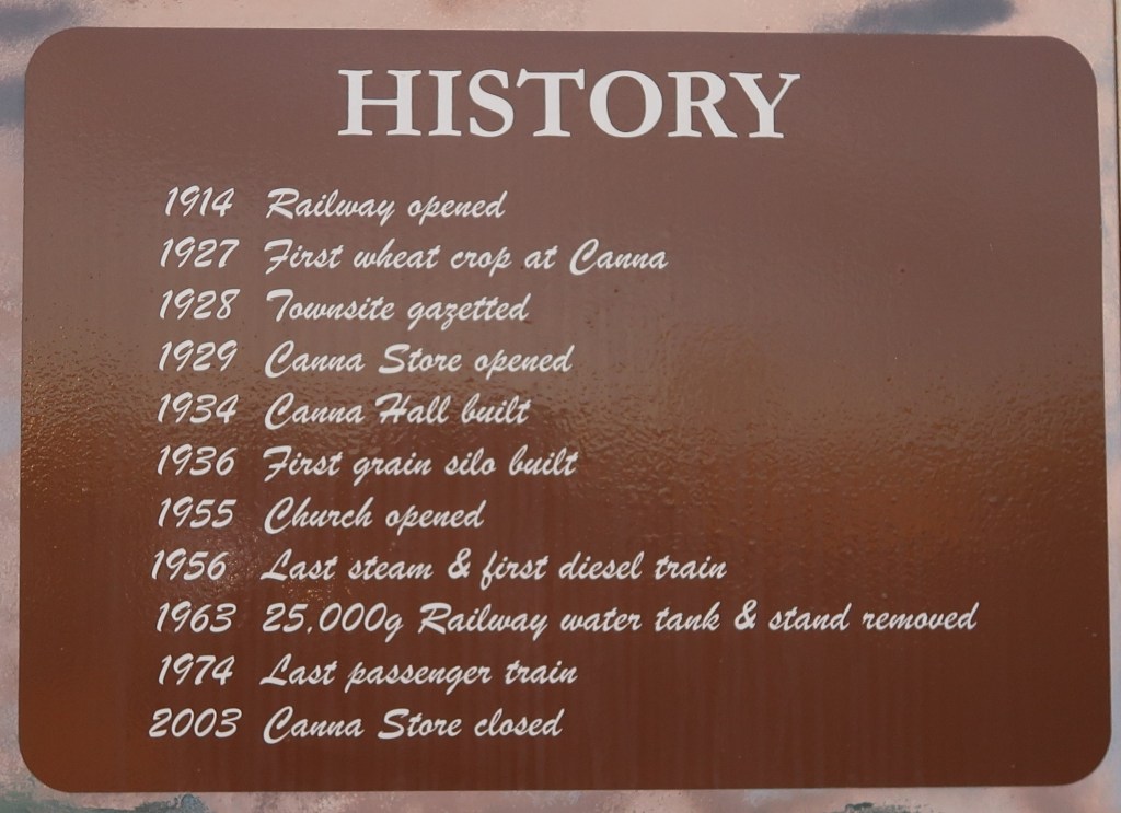
- 1909: Early European settlers begin obtaining fresh water from Koolanooka Springs.
- 1911: A Morawa deputation presses the Premier for the construction of a railway line.
- 1913: The Public Works Department proposes a siding named Pindawa at the 51 mile, 2 chain peg.
- 1914: The name Pindawa is rejected due to similarity with Pindar; the name Canna is selected instead.
- 1914: Land for the township is excised from Victoria Locations following railway construction.
- 1915: The Wongan Hills to Mullewa Railway line officially opens for traffic with Canna as a stopping place.
- 1915: Railway dams are constructed to provide water for steam locomotives.
- 1919: Interments begin at the unofficial Pintharuka Cemetery.
- 1928: The Canna townsite is formally gazetted with sixteen blocks offered for sale.
- 1929: The Canna Pioneer Store and Post Office officially opens on 27 April.
- 1931: A hardtimes costume dance is held at the Pindawa woolshed to raise funds for the local band.
- 1932: The Pintharuka Cemetery is officially opened on 26 February.
- 1933: The CBH Group is created, leading to the transition from bagged to bulk wheat transport.
- 1935: The Canna Hall is constructed, designed by Anne Harman and Norm Harris.
- 1947: The first resident Lutheran Minister, Lawrence Grieger, arrives in the district.
- 1947: The Canna townsite school begins operating from the community hall.
- 1949: A new Lutheran congregation is formally formed at Canna on 11 November.
- 1950: Frank Macklin establishes his camp at the Canna railway dam.
- 1952: The school at the Canna Hall ceases operations.
- 1954: Hand pressing of 22,000 cement bricks for the Lutheran church begins at Pindawa Homestead.
- 1955: The Canna Trinity Lutheran Church is dedicated on 10 July.
- 1959: The first wedding is held at the Trinity Church for Gloria Kowald and Roy Micke.
- 1968: Frank Macklin passes away at the age of 85.
- 1973: The Morawa District Historical Society constructs a stone boundary and plaque for the cemetery.
- 2003: The Canna Pioneer Store ceases operations as a general goods supplier.
- 2021: The Canna Trinity Lutheran Church is sold into private ownership.
Map
Sources
- Dance at Pindawa. (1931, November 7). The Mullewa Mail (WA : 1921 – 1947), p. 7. Retrieved August 18, 2026, from http://nla.gov.au/nla.news-article240347333 ↩︎
- Landgate (2022). Historic Town Names. Retrieved from the internet archive on 18 Aug 2026 from https://web.archive.org/web/20220314101618/http://www0.landgate.wa.gov.au/maps-and-imagery/wa-geographic-names/name-history/historical-town-names#C ↩︎
- CANNA COMMENTS (1950, September 28). Greenough Sun (WA : 1947 – 1954), p. 3. Retrieved August 18, 2026, from http://nla.gov.au/nla.news-article258744899 ↩︎
- Wikipedia (2022). Canna, Western Australia. Retrieved 18 Aug 2026 from https://en.wikipedia.org/wiki/Canna,_Western_Australia ↩︎
- Rail Heritage WA (1924). 1 of 3 images of the construction of the railway dam at Canna P13497. Photo taken 1924; photographer unknown. Retrieved 18 Aug 2026 from http://railheritagewa.org.au/archive_scans/displayimage.php?pid=14429 ↩︎
- Shire of Morawa (2022). Local Heritage Survey: Part 2. Retrieved 18 Aug 2026 from https://www.morawa.wa.gov.au/Profiles/morawa/Assets/ClientData/Document-Centre/Heritage_Information/Part_2_-_App_2_Local_Heritage_Survey_2022.pdf ↩︎
- ibid : Local Heritage Survey: Part 5. Retrieved 18 Aug 2026 from https://www.morawa.wa.gov.au/Profiles/morawa/Assets/ClientData/Document-Centre/Heritage_Information/Part_5_-_App_7_-_Site_Information.pdf ↩︎
- Barnes, Ian (2026). Canna Trinity Lutheran Church. Photographs donated by the photographer. ↩︎
- Carnamah Historical Society (n.d.) WA Livestock Brands 1912-1962. Retrieved 18 Aug 2026 from https://www.carnamah.com.au/livestock-brands?keyword=Canna ↩︎
- Shire of Morawa (2022). Local Heritage Survey: Part 5. Place No. 69 ↩︎
- Carnamah Historical Society (n.d.) WA State School Teachers 1900-1980. Retrieved 18 Aug 2026 from https://www.carnamah.com.au/teachers?keyword=Canna+ ↩︎
- Barnes, Ian (2026). Canna School. Photograph donated by the photographer. ↩︎
- Wikipedia (2024). CBH grain receival points. Retrieved 18 Aug 2026 from https://en.wikipedia.org/wiki/CBH_grain_receival_points ↩︎
- Western Australian Now & Then (n.d.) Canna, Wheatbelt Town, Western Australia. Retrieved 18 Aug 2026 from https://www.wanowandthen.com/Canna.html ↩︎
- Shire of Morawa (2026). Canna. Retrieved 18 Aug 2026 from https://www.morawa.wa.gov.au/tourism/what-to-do/canna-landmark.aspx ↩︎
- Australian Bureau of Statistics (2021). 2021 Census All persons QuickStats. Retreived 18 Aug 2026 from https://abs.gov.au/census/find-census-data/quickstats/2021/SAL50243 ↩︎
- Open Street Map (2026). 2026 location of Canna townsite. Retrieved 6 Sep 2026 from https://www.openstreetmap.org/search?query=-28.81879096398886%2C+115.87426246523307&zoom=10&minlon=113.57940673828126&minlat=-29.54717721331581&maxlon=116.21612548828126&maxlat=-28.519382767818374#map=9/-28.572/116.517&layers=C ↩︎
Versions
| Date | Changes |
|---|---|
| 19 Aug 2026 | Version 0.1 – First draft |
| 6 Sep 2026 | Version 0.2 – Second draft |
| 6 Sep 2026 | Version 1.0 – First published |

