Christine Harris 2026
Demographics
Region: Mid West
LGA: Three Springs
Industry: Agriculture
Other Names: Dudewa
Open Street Map: -29.369292914848227, 115.7780252215351
What3Words: ///untoward.steely.curving
Settled: 1905
Gazetted: N/A
Abandoned: About 1938
Abstract
Located approximately 310 kilometres north of Perth within the Shire of Three Springs, Dudawa (occasionally spelled Dudewa) represents a quintessential example of Western Australian rural development. The locality’s history as a European settlement began in 1906 when Lindsay McKinnon opened a repurchased estate, initiating a period of rapid agricultural expansion supported by essential water infrastructure like the 1908 Dudawa Dam. Throughout the early 20th century, Dudawa developed a robust social fabric centred on the Dudawa State School and local sporting clubs, reflecting a community that valued both industry and leisure.
The community faced significant trials during the Great Depression and World War II, the latter of which saw Dudawa gain strategic importance through Alby Sheppard’s “Tamma Mia” airstrip, a site noted even by Japanese military intelligence. Economically, the region evolved from pioneer wheat and sheep farming to include significant mineral interests, specifically talc mining, which led to landmark legal battles over mineral rights. While the mid-20th century saw a decline in local infrastructure, such as the 1938 closure of the school, Dudawa persists today as a small, focused primary production area. This article explores these historical milestones, providing insight into the social, political, and environmental factors that have shaped this enduring Midwest community.
History
The history of Dudawa, a locality in the Mid West region of Western Australia, is a narrative of grit and agricultural ambition. Originally part of the larger Woopenatty Station, the area was “discovered” for intensive settlement when the state government repurchased the estate for selection in the early 1900s. The formal recognition of the area’s potential began on 5 December 1905, when land was specifically reserved for a water catchment zone.1 2
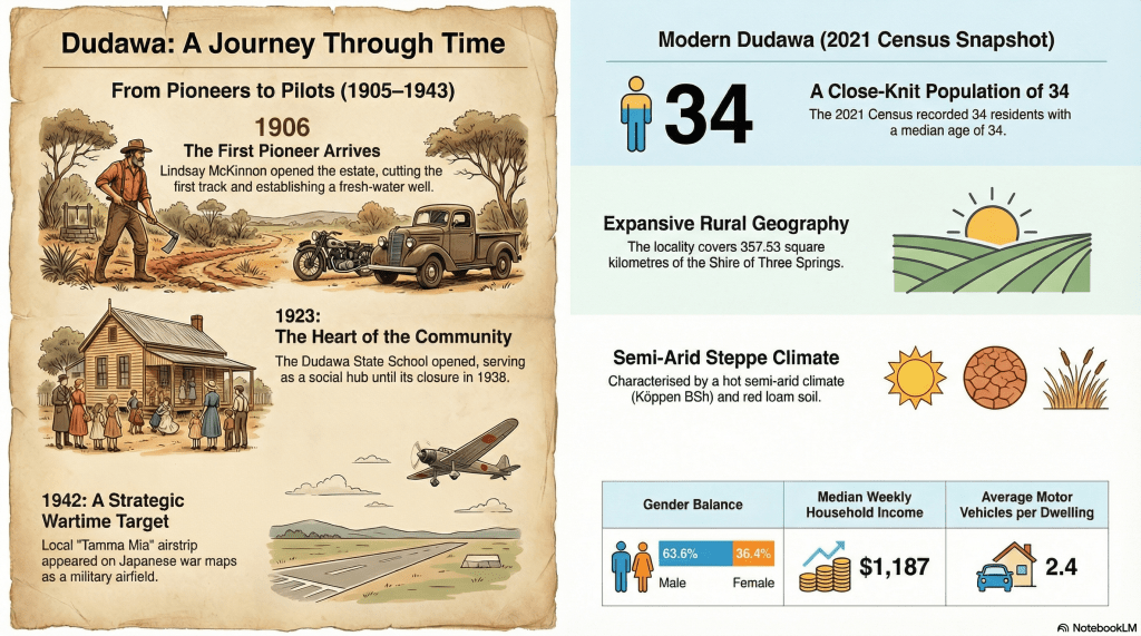
The arrival of the first pioneer, Lindsay McKinnon, in 1906 marked the true birth of the Dudawa community. McKinnon faced a formidable landscape of sand plains and dense scrub, but he successfully cut a track from the nearby railway siding at Arrino to the new estate. His early advocacy for infrastructure led to the government sinking a well in 1907, providing the permanent fresh water supply necessary to sustain a “civilised” settlement. By 1908, the community was described as “rising and progressive,” with settlers such as the Stokes brothers clearing hundreds of acres for wheat cultivation.3 4
Infrastructure and Growth
Economic growth in Dudawa was inextricably linked to environmental management. The completion of the Dudawa Dam on 13 November 1908 was a major milestone. Constructed with horses and scoops, the dam held 3,400 cubic yards of water from Geebulla Creek, serving as a vital lifeline for livestock and steam-powered farming machinery.
The community’s growth was not merely economic but deeply social. In July 1923, the Dudawa State School (often recorded as Dudewa) opened its doors to local children. This weatherboard and corrugated iron structure became the heart of the community, hosting “Christmas Tree” celebrations and serving as a focal point for families. The school’s history reflects the demographic ebbs and flows of the era; it closed temporarily in 1925 before reopening in 1926 under the guidance of dedicated teachers like Leslie Sawyer.5
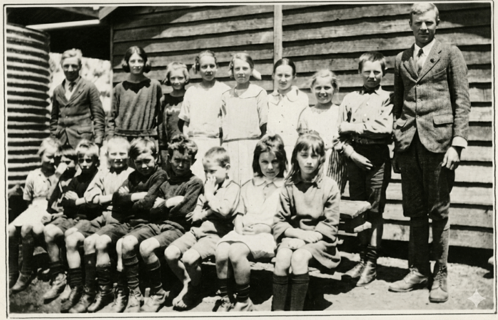
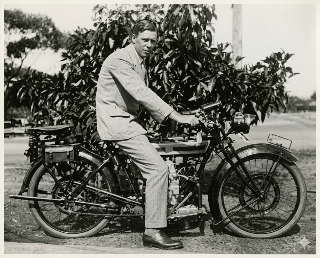
During the 1920s, social life flourished. The Arrino-Dudawa Race Club and local cricket teams provided an outlet for the hard-working farmers, while the red clay tennis courts built in 1922 offered a venue for Sunday recreation. Correspondence from the time, such as letters by Mina Sheppard in 1924, paints a picture of a community where holiday stories and local news were shared with warmth despite the challenges of “sore eyes” and heat.7 8 9
Economic Shifts and the Talc Discovery
While wheat and sheep remained the primary economic drivers, a chance discovery on the Barrett family’s Coodawa farm changed the region’s industrial profile. On the banks of a dam, settlers found “soapstone” that remained white even when marked on iron in a blacksmith’s forge. This substance was later identified by the Mines Department as high-quality talc.
The political and legal ramifications of this discovery were significant. Because the land had been part of a Midland Railway Company grant, the mineral rights belonged to the company rather than the farmers. This led to a landmark legal battle when the Taxation Department attempted to claim royalties from the Barrett family. The case eventually reached the High Court of Australia, which ruled in the family’s favour, determining that the payments were compensation for land disturbance rather than taxable royalties.10 11
The Impact of Global Conflict
World War II brought both hardship and a strange form of international recognition to Dudawa. Alby Sheppard, a local aircraft enthusiast, had constructed a private airstrip on his “Tamma Mia” property in the 1930s. By December 1933, it was hailed by the Inspector of Aerodromes as one of the finest landing grounds in the state.12
During the war, this “modest aerodrome” appeared on a 1942 Japanese military map, marked as a significant “military airfield”—the only one recorded between Geraldton and Perth. Local farmers like Alby and John Sheppard joined the Volunteer Defence Corps (VDC), while the community adapted to extreme fuel rationing by using charcoal gas producers on their tractors and school buses. The constant “air-spotting” duties at the school and the blacking out of headlights were daily reminders of the locality’s proximity to the conflict.14 15
Decline and Modern Context
The post-war era saw a gradual decline in Dudawa’s dedicated infrastructure as the population consolidated into larger town centres. The Dudawa School closed its doors for the last time in December 1938, and many families eventually moved to Three Springs or Dongara for education and business. The community sheep dip, a collaborative project funded by local farmers in 1950, fell out of use by 1962.16 17
Despite these closures, Dudawa remains a productive agricultural locality. The 2021 Census recorded a population of 34 people living in 16 private dwellings, with a median age of 34. The area covers approximately 357 square kilometres and continues to face environmental challenges. Most recently, in March 2024, the community was threatened by a massive 5,213-hectare bushfire, necessitating emergency advice and highlighting the ongoing risks of life in the semi-arid Midwest.18 19 20
Conclusion
Dudawa’s history is a testament to the endurance of the Western Australian farmer. From the first track cut through the scrub in 1906 to the strategic airstrips of World War II and the legal battles over talc, the community has navigated social, economic, and political shifts with resilience. Today, while only the site of the school remains, marked by a plaque, the legacy of the pioneers lives on in the productive fields and the enduring spirit of the families who still call this “Red Bank” home.
Timeline
- December 1905: Land reserved as a water catchment zone to support the Dudawa area.
- 1906: Arrival of first pioneer Lindsay McKinnon; a track is cut from Arrino to Dudawa.
- 1907: Construction of the Government Well begins.
- 13 November 1908: Completion of the Dudawa Dam to store water from Geebulla Creek.
- 1912: First recorded livestock brands for local settlers such as N. Stokes and C. Sheahan.
- 1922: Construction of the red clay tennis courts and bush shelter.
- 25 July 1923: Dudawa State School officially opens with Walter Henderson as the first teacher.
- April 1924: Local resident Mina Sheppard writes of her holiday reflections and community spirit.
- September 1925: Death of prominent local farmer Michael Joseph Carroll at age 31.
- 2 November 1928: Constitution of the Three Springs Road District from neighbouring districts.
- December 1938: The Dudawa State School closes permanently.
- 1942: Alby Sheppard’s airstrip at “Tamma Mia” is marked as a military airfield on a Japanese war map.
- 1943: The airstrip is officially recorded as a “C Class Emergency Landing Ground” by Australian forces.
- Circa 1950: Construction of the community sheep dip by local farmers.
- 1962: Last recorded use of the community sheep dip.
- 1970: Construction of a public standpipe for water access.
- July 1996: The Dudawa School site and Water Reserve are adopted into the Municipal Inventory of Heritage Places.
- March 2024: Major bushfires impact the Dudawa and Arrino areas, burning over 5,000 hectares.
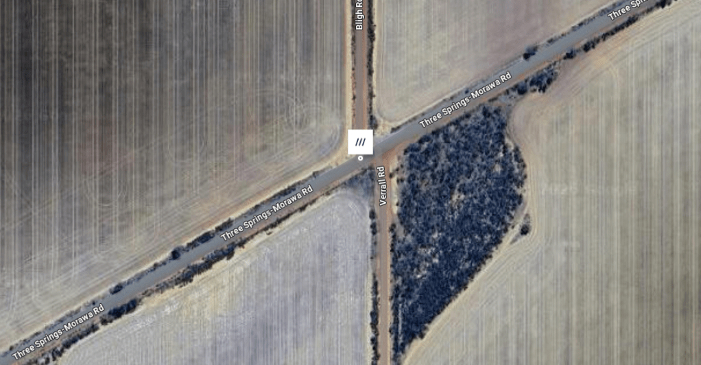
Map
Sources
- Heritage Council of WA (2002). Dudawa Water Reserve. Retrieved 27 Feb 2026 from https://inherit.dplh.wa.gov.au/public/inventory/details/1ddb7a4a-db64-4feb-acf7-eb8d907ea6bb ↩︎
- Arrino. (1908, June 12). The Midlands Advertiser (Moora, WA : 1907 – 1930), p. 5. Retrieved February 27, 2026, from http://nla.gov.au/nla.news-article156501814 ↩︎
- ibid ↩︎
- Heritage Council of WA (1997). Dudawa School & Quarters. Retrieved 27 Feb 2026 from https://inherit.dplh.wa.gov.au/public/inventory/details/cac2672f-0af6-4cb4-896e-49495d98b123 ↩︎
- ibid ↩︎
- Rural State School Children. (1924, December 25). Western Mail (Perth, WA : 1885 – 1954), p. 6 (PICTORLAL SECTION). Retrieved February 27, 2026, from http://nla.gov.au/nla.news-article37818724 ↩︎
- Carnamah Historical Society & Museum and North Midlands Project, ‘Michael Joseph Carroll’ in Biographical Dictionary of Coorow, Carnamah and Three Springs, retrieved 27 February 2026 from www.carnamah.com.au/bio/michael-joseph-carroll ↩︎
- Carnamah Historical Society & Museum and North Midlands Project, ‘William Nicholas Stokes’ in Biographical Dictionary of Coorow, Carnamah and Three Springs, retrieved 27 February 2026 from www.carnamah.com.au/bio/william-nicholas-stokes ↩︎
- From Dudawa. (1924, April 10). Western Mail (Perth, WA : 1885 – 1954), p. 38. Retrieved February 27, 2026, from http://nla.gov.au/nla.news-article37630592 ↩︎
- CaseNote.au (1968). High Court of Australia: Barrett v Federal Commissioner of Taxation. Retrieved 27 Feb 2026 from https://casenote.au/cases/barrett-v-federal-commissioner-of-taxation ↩︎
- State Library of Western Australia (2015). Shire of Irwin – Dongara Oral History Project: Interview with Donald (Don) and Aileen Barrett in May 2015; interviewed by Trish Parker. Retrieved 27 Feb 2026 from https://encore.slwa.wa.gov.au/iii/encore/record/C__Rb5232800 ↩︎
- ibid ↩︎
- A DUDAWA RIDER AND HIS DOUGLAS (1926, August 15). Sunday Times (Perth, WA : 1902 – 1955), p. 8 (Third Section). Retrieved February 27, 2026, from http://nla.gov.au/nla.news-article58247167 ↩︎
- Sheppard, Bob (2018). Heritage Detection Australian: Sheppard airstrip on Japanese war map. Retrieved 27 Feb 2026 from https://heritagedetection.wordpress.com/2018/06/24/sheppard-airstrip-on-ww2-japanese-map/ ↩︎
- SLWA, 2015: refers to Sheppard ↩︎
- Heritage Council, 2017: refers to school closure ↩︎
- SLWA, 2015: refers to move away from Dudawa ↩︎
- Australian Bureau of Statistics (2021). 2021 Census All Persons QuickStats: Dudawa. Retrieved 27 Feb 2026 from https://abs.gov.au/census/find-census-data/quickstats/2021/SAL50429 ↩︎
- Wikipedia (2023). Shire of Three Springs. Retrieved 27 Feb 2026 from https://en.wikipedia.org/wiki/Shire_of_Three_Springs ↩︎
- ABC Emergency (2024). Parts of Dudewa in the Shire of Three Springs. Retrieved 27 Feb 2026 from https://www.abc.net.au/emergency/warning/wa/AUREMER-23125b8bc5643864453fcb3cd8765374 ↩︎
- what3words.com (2026). Dudawa. Retrieved 27 Feb 2026 from https://what3words.com/untoward.steely.curving ↩︎
