Produced using AI and NotebookLM
Demographics
Region: Wheatbelt
LGA: Kulin
Industry: Agriculture
Other Names: Geetaring
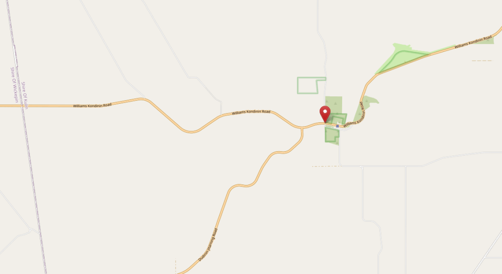
Open Street Map: -32.7859, 117.9966
What3Words: ///buying.transpired.sadden
Settled: 1911
Gazetted: 1917
Abstract
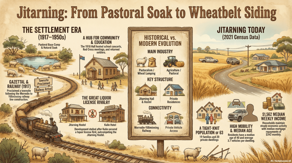
Located in the heart of Western Australia’s Wheatbelt, Jitarning serves as a poignant example of the rise and fall of small rail-side settlements in the early 20th century. Originally anchored by the essential Geetaring Soak, the community was formally gazetted in 1917 following the arrival of the Merredin-Yilliminning railway line. Despite early social prosperity marked by the construction of a grand community hall and a large hostel, the town’s urban development was effectively halted by political and economic competition from neighbouring Kulin. While Jitarning remained a vital agricultural hub for decades, supported by a local school and a network of resilient farming families, the mid-20th century saw a transition toward a more dispersed, quiet locality. Today, with a population of just 63 people, Jitarning stands as a testament to the enduring spirit of the Wheatbelt’s pastoral pioneers.
History
The history of Jitarning, a locality tucked within the Shire of Kulin in Western Australia’s Wheatbelt, is a narrative of environmental necessity, railway-driven ambition, and the harsh realities of economic competition. To understand Jitarning is to understand the vital importance of water in the arid interior of the state. Long before the town was a dot on a map, the area was known for the Jitarning (formerly Geetaring) Soak, a natural water source that dictated the movement of both Indigenous custodians and early European explorers. It was this environmental anchor that led Michael Brown, a pivotal figure who founded the Narrogin Road Board and Narrogin Flour Mills, to establish a pastoral lease and base camp at the site. The presence of reliable water was the primary factor that drew in the initial wave of settlers who would eventually form the backbone of the community.1
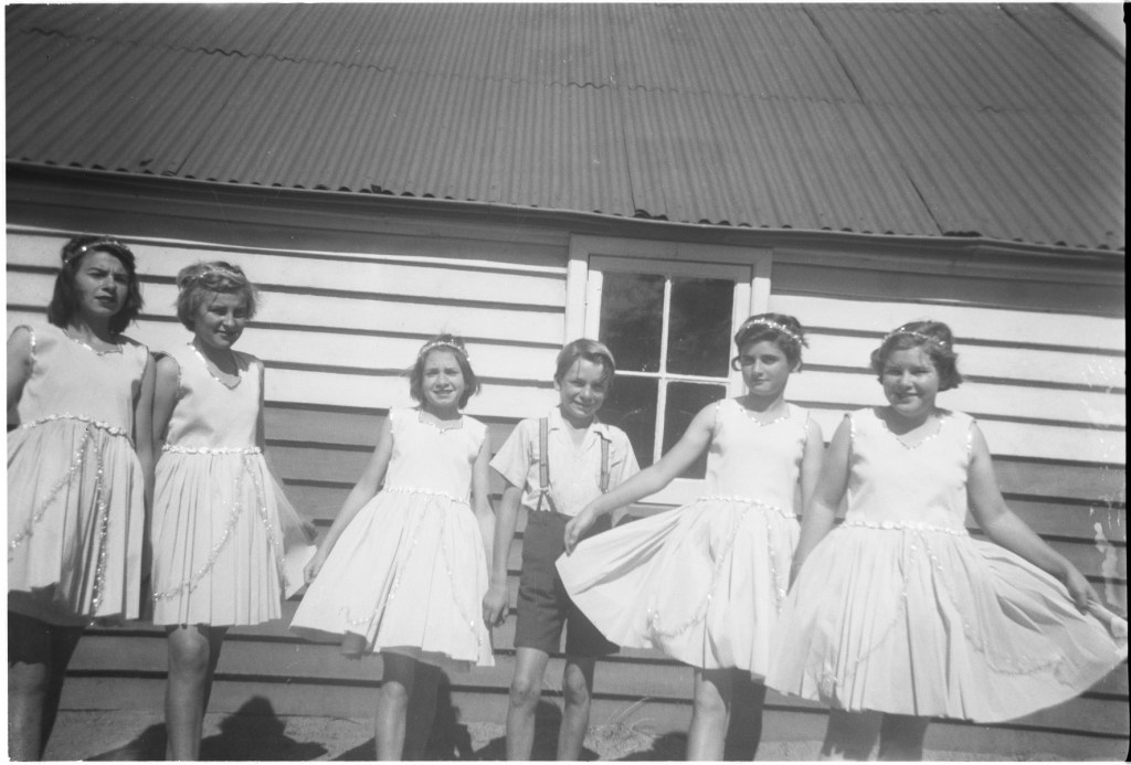
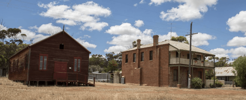
The formal birth of the town was a political and logistical milestone, tied directly to the expansion of the Western Australian Government Railways. In 1917, Jitarning was officially gazetted following the construction of the Merredin to Yilliminning railway line. The railway was the lifeblood of the fledgling settlement, providing the necessary infrastructure to transport the region’s burgeoning wheat and livestock to distant markets. With the siding established, the town began to take physical shape. By 1918, the community’s social infrastructure arrived in the form of the Jitarning Hall and the Jitarning Hostel. The hall, a timber-framed building, was opened on 5 October 1918, just in time to serve as a venue for welcoming home soldiers returning from the First World War. This building became the societal heart of the district, hosting dances, Christmas trees, school concerts, and meetings for the Country Women’s Association (CWA) and the Red Cross.
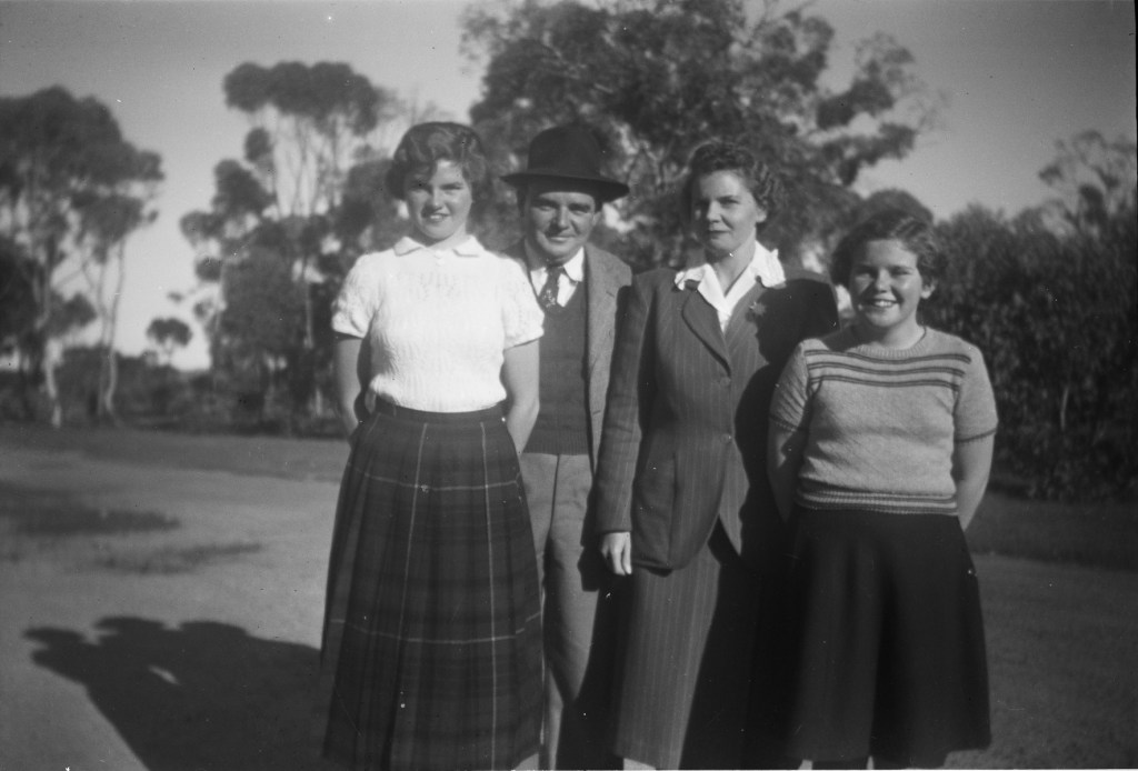
SLWA2
However, the year 1918 also marked a significant economic turning point that would forever alter Jitarning’s growth trajectory. The Jitarning Hostel was originally constructed with the intent of becoming a fully licensed hotel, a development that typically signalled the transition of a siding into a major town. By the time the owners applied for a licence, the Kulin Hotel had already successfully secured its own. In a period of strict licensing regulations, the authorities favoured the neighbouring settlement, and Jitarning was denied. This political and economic decision proved catastrophic for the town’s urban expansion. Without a hotel, Jitarning could not compete with the commercial gravity of Kulin. The building instead became a hostel for itinerant workers, wheat lumpers, and the local school teacher, and eventually settled into its current role as a private residence.
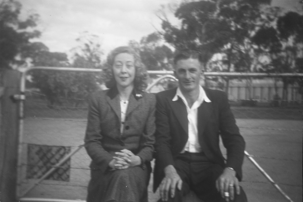
SLWA3
Despite the lack of a commercial centre, the genealogical records of the town show a vibrant and growing community of families throughout the 1920s and 1930s. Education was a central focus, with the Jitarning School providing a constant presence from at least 1923. The list of head teachers serves as a roll call of the community’s leaders: Helene Langenback (1923–24), Gladys John (1925–26), Edith Ware (1927–29), and Alma Scotson (1930–33), among others. These educators, often residing at the local hostel, were essential to the societal stability of the remote farming families. The 1920s saw further investment in social infrastructure, including a stage and supper room added to the hall in 1924, reflecting a community that, while small, was deeply invested in its local culture.4 5
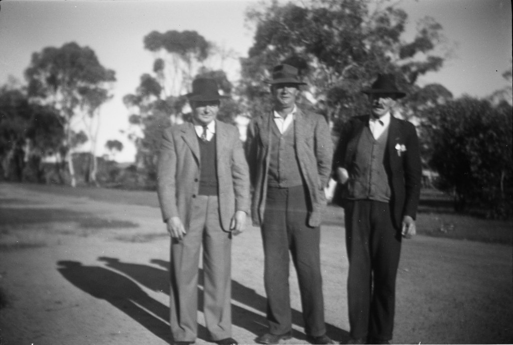
The economic foundation of Jitarning was built on the backs of pioneering families who took up land under various settlement schemes. Names such as Andrews, Brodie, Connor, Cook, Crowe, Dickenson, and Pyne appear in the early livestock brand registries, representing the primary industry of the district. Wyndham Francis Pyne, for instance, arrived from England in 1923 and commenced farming at Jitarning in 1929, raising a family that would contribute to the area for decades. These families faced immense environmental challenges, clearing “virgin bush” and suffering through the privations of the Great Depression. Yet, they persisted, with the 1962 brand registry showing many of the same names—Anderson, Britza, Kirby, and Wilson—still tending the land, indicating a high level of generational continuity.6 7
SLWA8
As the 20th century progressed, societal and economic shifts led to a gradual consolidation of the community. The improved reliability of motor vehicles—reflected today in Jitarning’s high average of 3.7 vehicles per household—meant that residents could easily travel to Kulin or Narrogin for services, reducing the need for a local commercial precinct. The school, which had seen teachers like Marie Strickland and Lucy Torrisi as late as 1949 and 1950, eventually closed its doors, and the various stores, such as Randall’s Store, faded into history. By the late 20th century, the Heritage Council recognised the Jitarning townsite as a historic area, noting the sites of the former Co-op Store and the school as significant landmarks of a bygone era.9 10
In the modern era, Jitarning has settled into its role as a small, quiet locality within the Wheatbelt. The 2021 Census paints a picture of a tight-knit community of 63 people living in 20 private dwellings. The demographic is mature, with a median age of 40, and the population is predominantly male at 58.3%. The community remains family-oriented, with 19 families recorded in the latest data. While the bustling town centre envisioned by the builders of the 1918 hostel never fully materialised, the Jitarning Hall still stands as a reminder of the social ambitions of the early settlers.11 12
SLWA13
SLWA14
The history of Jitarning is a story of environmental destiny. It began with a soak, was fuelled by a train, and was ultimately defined by its proximity to more successful rivals. For the genealogist, Jitarning provides a rich tapestry of names and brands that link the current landscape to the pioneers of 1917. For the historian, it offers a lesson in how political decisions, such as the granting of a single liquor licence, can dictate the survival and form of a community for over a century. Today, Jitarning is no longer the burgeoning siding it once was, but it remains a vital, living part of the Western Australian Wheatbelt.
Timeline
- Pre-1917: Michael Brown establishes a base camp at Jitarning (Geetaring) Soak on a pastoral lease.
- 1917: Jitarning is officially gazetted as a townsite following the arrival of the Merredin-Yilliminning railway.
- 5 October 1918: The Jitarning Hall officially opens, serving as a social hub and a venue to welcome WWI soldiers.
- 1918: The Jitarning Hostel is built; however, it is denied a liquor licence, which stifles the town’s commercial growth in favour of Kulin.
- 1923: Helene Langenback begins her tenure as the head teacher at the Jitarning school.
- 1924: Significant extensions are added to the Jitarning Hall, including a supper room and stage.
- 1929: Wyndham Francis Pyne commences farming in the district, representing a wave of post-WWI migrant settlers.
- 1931: Alma Scotson serves as head teacher during the height of the Great Depression.
- 1943: The Regent Parrot is first recorded as colonising the Swan Coastal Plain, a shift in regional bird populations noted by local observers.
- 1950: Lucy Torrisi is listed as the head teacher for the High School level, marking the end of the teacher registry in available records.
- 1962: A robust list of livestock brands (e.g., Britza, Brodie, Wilson) confirms Jitarning remains a productive agricultural region.
- 1997: The Shire of Kulin adopts a Municipal Inventory, listing the Jitarning townsite as a significant historic area.
- 2021: The Australian Census records a population of 63 residents and 20 private dwellings in the Jitarning locality.
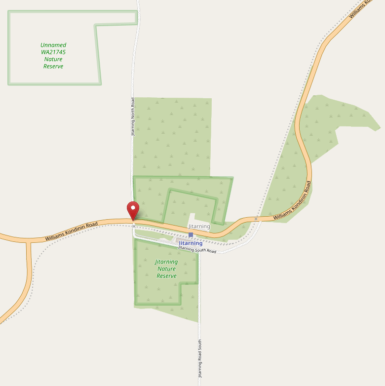
Maps
Sources
- Wikipedia, 2023. Jitarning. Retrieved 11 Feb 2026 from https://en.wikipedia.org/wiki/Jitarning ↩︎
- State Library of Western Australia, n.d. Lucy Dowling collection of photographs. Retrieved 11 Feb 2026 from
Lucy Dowling collection of photographs ; BA3095/36-38. ↩︎ - State Library of Western Australia, n.d. Philip Gostelow collection of photographs. Record ID – BA2493 retrieved 11 Feb 2026 from https://encore.slwa.wa.gov.au/iii/encore/record/C__Rb5281431 ↩︎
- Carnamah Historical Society & Museum, n.d. WA State School Teachers 1900-1980. Retrieved 12 Feb 2026 from https://www.carnamah.com.au/teachers?keyword=jitarning ↩︎
- Kulin Shire Council, 2026. Visit Kulin: Jitarning. Retrieved 12 Feb 2026 from https://www.visitkulin.com.au/welcome/surrounding-towns/jitarning.aspx ↩︎
- Carnamah Historical Society & Museum, n.d. WA Livestock Brands 1912-1962. Retrieved 12 Feb 2026 fromhttps://www.carnamah.com.au/livestock-brands?keyword=Jitarning ↩︎
- Western Australian Museum, n.d. Welcome Walls: PYNE, Wyndham Francis. Retrieved 12 Feb 2026 from https://museum.wa.gov.au/welcomewalls/names/pyne-wyndham-francis ↩︎
- State Library of Western Australia, n.d. Lucy Dowling collection of photographs. Record BA3095/28-30, 35 retrieved 11 Feb 2026 from https://encore.slwa.wa.gov.au/iii/encore/record/C__Rb6097570 ↩︎
- Heritage Council WA, 2016. Jitarning Townsite. Retrieved 12 Feb 2026 from https://inherit.dplh.wa.gov.au/public/inventory/details/c84e84eb-01c6-43c3-a12f-5f4577a14d08 ↩︎
- Carnamah Historical Society & Museum, n.d. WA State School Teachers 1900-1980. Retrieved 12 Feb 2026 from https://www.carnamah.com.au/teachers?keyword=jitarning ↩︎
- Kulin Shire Council, 2026. Visit Kulin: Jitarning. Retrieved 12 Feb 2026 from https://www.visitkulin.com.au/welcome/surrounding-towns/jitarning.aspx ↩︎
- Australian Bureau of Statistics, 2021. 2021 Census All persons QuickStats: Jitarning. Retrieved 12 Feb 2026 from https://abs.gov.au/census/find-census-data/quickstats/2021/SAL50699 ↩︎
- State Library of Western Australia, n.d. Lucy Dowling collection of photographs. Record BA3095/28-30, 35 retrieved 11 Feb 2026 from https://encore.slwa.wa.gov.au/iii/encore/record/C__Rb6097570 ↩︎
- State Library of Western Australia, n.d. Lucy Dowling collection of photographs. Record BA3095/31-33 retrieved 11 Feb 2026 from https://encore.slwa.wa.gov.au/iii/encore/record/C__Rb6097625 ↩︎
Further Reading
- Gray, Laura. 1995. Jitarning Hall : conservations plan : prepared for Jitarning Hall Investigative Committee. Available SLWA, 2nd Floor Heritage Stack (Call number Q 725.8 GRA)
