
State Records Office of WA1
Demographics
Region: Mid West
LGA: Northampton
Industry: Primary industry
Other Names: Yuba
Open Street Map:
What3Words:
Settled:
Gazetted:
Abandoned:
Abstract
Ogilvie, originally known as Yuba, is a remote agricultural locality in Western Australia, established primarily during a land selection boom in the early 1910s. Key early milestones included the reservation of the Yuba townsite (1912) and the opening of the Yuba No. 1 school (1912). The community formalized its growth with the establishment of the Ogilvie Agricultural Hall (1919), which served multifunctionally as a church, school, and social centre. Economically centered on wheat, barley, and sheep, the community faced severe environmental impacts, notably lobbying to declare emus as vermin in the 1920s due to widespread crop destruction. Today, Ogilvie is a large locality by area (596.8 km²) but retains a small, highly stable population of 56 (2021 Census), reflecting long-term rural consolidation.
History
The Western Australian locality of Ogilvie, situated approximately 70 kilometres north of Geraldton within the Shire of Northampton, carries a dual identity deeply rooted in the history of settlement, having been known by the evocative earlier name of Yuba. Its history is a potent microcosm of the challenges faced by pioneers who sought to conquer the semi-arid lands of the Mid West, balancing the potential prosperity of agriculture against harsh environmental realities.2 3 4
The Dawn of Yuba: A Remote Outpost
Long before official town plans were laid, the name Yuba marked a rural spot. Records dating back to 1890 identify Yuba as a remote area about 26 miles from Northampton. This early phase reflected the struggle of isolated pastoral life, marked by basic necessities and often tragedy, such as the sudden death of old shepherd Patrick Quility there in 1890.5
The true establishment of Yuba as a prospective agricultural community began around the turn of the century, propelled by government policy focused on land settlement and infrastructure extension. By 1909, surveyors were carrying out extensive operations from Yuba north to the Murchison River to facilitate the Northern extension of the Northampton railway. The region, situated about 18 to 20 miles northeast by north of Northampton, offered around 30,000 acres of genuinely excellent mixed-farming country. This land, largely described as “york gum” country mingled with wattle and jam thickets, was highly desired, attracting applicants ready to give up land in other parts of the State, such as Kojonup, just to select a block near Port Gregory or Yuba. The expectation was that 80,000 to 100,000 acres would be made available for selection.6 7 8
Crucial to the dream of successful remote settlement was reliable logistics. It was understood early on that farming was generally not profitable beyond a certain distance (estimated at roughly 20 miles) from a railway, positioning the proposed line extension as a vital developmental necessity. Water, too, was key, and encouragingly, excellent water conditions prevailed throughout the area, typically found in wells at a mean depth of 16 feet.9
Formal civic life soon followed the initial land rush, centered on education and local organization. Land (Victoria Location 4551) was reserved for the Yuba townsite near Northampton-Ajana in 1912. The foundational Yuba No. 1 school opened its doors on December 4, 1912, providing an anchor for the scattered families. Further demonstrating local initiative, the Yuba Farmers & Settlers Association succeeded in establishing a reserve specifically for recreation by 1914.10 11 12
The Naming of Ogilvie and Community Growth
The official naming convention soon shifted. The settlement became officially known as Ogilvie by 1916, a likely tribute to Andrew Jameson Ogilvie (who died in 1906), the influential landowner of the Murchison House Station located nearby. The name transfer was evident in the development of railway infrastructure, where the siding of Ogilvie replaced the previous name Mandalo, just as the Hutt siding replaced Yuba No. 1.13 14
Despite the challenges of rural life, the community grew vigorously, prioritizing social cohesion. The Ogilvie State School was established by 1917, the same year two acres were reserved specifically for a tennis court. The pinnacle of local infrastructure was the Ogilvie Agricultural Hall, opened in May 1919. This single structure was the heart of the community, flexibly serving as a place for dances, a church, and even doubling as the local school, maximizing the utility of communal resources. This sense of community extended to sport; by July 1929, the local football team, the Yuba Wanderers, was actively competing against nearby towns like Nanson.15 16 17
Education continued to be a priority as settlement expanded, leading to the formal opening of the East Ogilvie school site in August 1939, built on land donated by Gordon Atkinson.18 After the upheaval of the Second World War, the community invested further in leisure, constructing and opening new tennis courts in December 1946. By 1953, the Agricultural Hall reflected sustained local activity, boasting an expansion that included a supper room and a nursery.19
Economic Life and the Environmental Struggle
The economic engine of Ogilvie was mixed farming, producing staples such as wheat, barley, oats, lupins, Wimmera rye, and clover, alongside sheep farming. However, maintaining profitable yields was a constant battle against the arid environment and its native inhabitants.
A persistent and challenging environmental impact came from native fauna deemed pests. The organized political voice of the community, the Ogilvie and District Branch of the Primary Producers’ Association (re-formed in July 1925), concentrated its early efforts on lobbying the Minister for Agriculture to declare emus as vermin due to severe and widespread crop destruction. This unique plea underscores the severity of the conflict between agriculture and Australia’s ecology on the frontier. The battle against pests continued; by 1946, farmers reported a notable impact from foxes on lambing stock, even during a year that yielded only a moderate wheat and barley harvest.20
Ensuring reliable water for farms was paramount in this hot semi-arid climate . The government’s Agricultural Areas Water Supply (A.A.W.S.) documented extensive development of wells and tanks throughout the Yuba district between 1918 and 1924, confirming the constant need to engineer water resilience. Collective safety measures were also recognized as essential, leading to efforts to form a fire brigade in 1952, necessary to protect valuable farming assets.21 22 23
Decline and Modern Resilience
Like many agricultural settlements established during the early 20th century land boom, Ogilvie experienced consolidation and a reduction in resident population in later decades. The various small, separate school sites like Yuba No. 1 (closed 1916) and East Ogilvie reflect the changing settlement patterns and the eventual need for educational centralization.24 25
Today, Ogilvie exists as a geographically expansive locality (covering 596.8 square kilometres) but has a sparse population. The 2021 Census recorded just 56 residents. The modern socio-economic profile suggests a stable, aging farming community: dwellings consist entirely of separate houses (100%), and ownership rates are remarkably high, with 80% of private dwellings owned outright. Most residents fall into a moderate income bracket ($400−$599 per week being the most common).26 27 28
The locality’s remote nature continues to feature prominently in modern events, as illustrated by the fatal light aircraft crash near Ogilvie Road West on March 25, 2025. The subsequent investigation by the Australian Transport Safety Bureau (ATSB) concluded that the experienced pilot, who was suffering from an acute gastrointestinal infection and likely dehydration, probably experienced an incapacitating medical event mid-flight. This tragic event serves as a contemporary reminder of the inherent risks associated with travel across the vast, isolated landscape that defines the Ogilvie district.29
Timeline
- 1890 (August 2): Yuba is noted as a rural location, 26 miles from Northampton, following the death of shepherd Patrick Quility.
- 1909 (October): Surveyors are subdividing the Yuba area, expected to yield 80,000 to 100,000 acres of mixed farming land for selection.
- 1909 (November 2): The suggestion for a railway extension from Northampton through the Yuba country is advocated to open up fine mixed-farming land.
- 1912 (December 4): Yuba No. 1 school opens.
- 1912: Land (Victoria Location 4551) is reserved for the Yuba townsite near Northampton-Ajana.
- 1914: Yuba Farmers & Settlers Association secures a reserve for recreation purposes.
- 1916: The locality is officially named Ogilvie. Yuba No. 1 School closes on August 23. The railway siding name changes from Yuba No. 1 to Hutt.
- 1917: Ogilvie State School is in existence, and two acres are set aside for a tennis court.
- 1918–1924: The Agricultural Areas Water Supply (A.A.W.S.) develops several wells and tanks in the Yuba district.
- 1919 (May): The Ogilvie Agricultural Hall opens, serving as a public hall, church, and local school.
- 1925 (July): The Ogilvie and District Branch of the Primary Producers’ Association re-forms and begins lobbying the Minister for Agriculture to declare emus as vermin due to crop destruction.
- 1929 (July): The local football team, the Yuba Wanderers, competes against Nanson.
- 1939 (August): East Ogilvie School formally opens on donated land.
- 1946 (December): New tennis courts are constructed and opened; this period sees continued issues with abundant emus and foxes impacting lambing stock.
- 1952: Efforts are initiated to form a community fire brigade.
- 1953: The Agricultural Hall has expanded to include a supper room and nursery.
- 2021: The population of the Ogilvie locality is recorded as 56.
- 2025 (March 25): A fatal light aircraft crash occurs near Ogilvie Road West; the investigation later suggests the experienced pilot likely suffered an incapacitating medical episode mid-flight.
Map
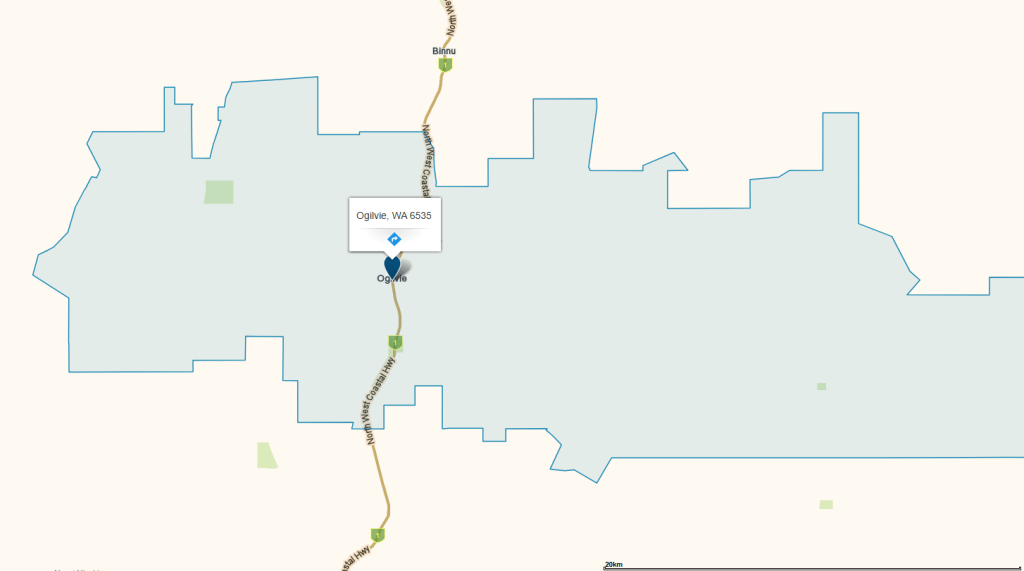
WhereIS30
Sources
- State Records Office of WA, 2015. Item Victoria 0952 – Near Yuba, survey of Locations 4249-4272, Yuba Subdivision by T.G. Lilliecrona [scale: 20 chains to an inch]. Cartographic material retrieved 5 Dec 2025 from https://archive.sro.wa.gov.au/index.php/near-yuba-survey-of-locations-4249-4272-yuba-subdivision-by-t-g-lilliecrona-scale-20-chains-to-an-inch-victoria-0952 ↩︎
- WhereIS, 2025. Ogilvie, WA 6535. Retrieved 6 Dec 2025 from https://www.whereis.com/wa/ogilvie-6535 ↩︎
- Wikipedia, 2025. Ogilvie, Western Australia. Retrieved 6 Dec 2025 from https://en.wikipedia.org/wiki/Ogilvie,_Western_Australia ↩︎
- Wikipedia, 2025. Shire of Northampton. Retrieved 5 Dec 2025 from https://en.wikipedia.org/wiki/Shire_of_Northampton ↩︎
- NORTHAMPTON. (1890, August 2). Victorian Express (Geraldton, WA : 1878 – 1894), p. 5. Retrieved December 5, 2025, from http://nla.gov.au/nla.news-article211272833 ↩︎
- Northampton Railway Extension (1909, November 2). Geraldton Guardian (WA : 1906 – 1928), p. 4. Retrieved December 5, 2025, from http://nla.gov.au/nla.news-article66279499 ↩︎
- LOCAL and GENERAL (1909, October 6). The Geraldton Express (WA : 1906 – 1928), p. 2. Retrieved December 6, 2025, from http://nla.gov.au/nla.news-article210923588 ↩︎
- News in Brief. (1909, October 11). Bunbury Herald (WA : 1892 – 1919), p. 3. Retrieved December 6, 2025, from http://nla.gov.au/nla.news-article87258363 ↩︎
- Geraldton Guardian, Nov 1909: refers to logistics and availability of water ↩︎
- State Records Office of WA, n.d. Search results for Yuba. Retrieved 5 Dec 2025 from https://archive.sro.wa.gov.au/index.php/informationobject/browse?topLod=0&query=Yuba ↩︎
- Heritage Council of WA, 2018. Yuba School – site. Retrieved 6 Dec 2025 from https://inherit.dplh.wa.gov.au/public/inventory/details/95ce2998-63c4-4d52-9b39-ec6a9a588d11 ↩︎
- State Records Office of WA, 1912. Yuba Farmers & Settlers Association. Reserve for recreation Yuba, Vic location 4576. AU WA S211 cons1657 1914/02191. ↩︎
- Wikipedia, Ogilvie: refers to the naming of Ogilvie ↩︎
- State Records Office of WA, 1913. Naming of sidings on Northampton to Ajana Railway.
AU WA S211 cons4799 1913/1503 V1 ↩︎ - Wikipedia, Ogilvie: refers to the Ogilvie Hall and its uses ↩︎
- Whereis, Ogilvie: refers to the school, hall and tennis court ↩︎
- NANSON V. YUBA (1929, July 2). Geraldton Guardian and Express (WA : 1929 – 1947), p. 1. Retrieved December 6, 2025, from http://nla.gov.au/nla.news-article67101568 ↩︎
- Heritage Council of WA, 2021. East Ogilvie School Site. Retrieved 5 Dec 2025 from https://inherit.dplh.wa.gov.au/public/inventory/details/6c3d108e-a95e-4f29-8948-7772f5d96f0e ↩︎
- Wikipedia, Ogilvie: refers to development of various community facilities ↩︎
- ibid: refers to struggle with pests and vermin and formation of association ↩︎
- mindat.org, n.d. Ogilvie, Northampton Shire, State of Western Australia, Australia. Retrieved 6 Dec 2025 from https://www.mindat.org/feature-8791796.html ↩︎
- State Records Office of WA, 1966. Item 1966/2102 V1 – History of Yuba. AU WA S211 cons4799 1966/2102 V1 ↩︎
- Wikipedia, Ogilvie: refers to formation of fire brigade ↩︎
- Heritage Council, Yuba School: refers to development and centralisation of educational facilities in Northampton ↩︎
- Heritage Council, Ogilvie School: refers to development and centralisation of educational facilities in Northampton ↩︎
- Wikidata, n.d. Ogilvie. Retrieved 6 Dec 2025 from https://www.wikidata.org/wiki/Q21887475 ↩︎
- Wikipedia, Northampton: refers to census data for shire ↩︎
- bonzle.com, n.d. Ogilvie, WA. Retrieved 5 Dec 2025 from http://bonzle.com.au/c/a?a=p&p=286063&cmd=sp&c=1&x=114%2E8523192&y=%2D28%2E3432449&w=85350&mpsec=0&s=noosa&m=13&st=WA ↩︎
- ABC News, 2025. Fatal crash in WA’s Midwest likely caused by medical episode, ATSB report reveals. Retrieved 6 Dec 2025 from https://www.abc.net.au/news/2025-10-14/plane-crash-atsb-medical-episode-ogilvie/105889274 ↩︎
- WhereIS, 2025. Ogilvie, WA 6535. Cartographic material retrieved 6 Dec 2025 from https://www.whereis.com/wa/ogilvie-6535 ↩︎
