
Region: Goldfields-Esperance
LGA: Shire of Cunderdin
Alternate Names: Ularring Rock, Ularring Soak
Industry: Water
Coordinates: 29° 55′ 59″ S, 120° 31′ 59″ E
What3Words: ///reckoned.resurrect.chugging
Population: 0
Started:
Gazetted:
Closed:
Mindat.org describes Ularring as:
Hill – a rounded elevation of limited extent rising above the surrounding land with local relief of less than 300m
Unfortunately, we don’t yet know a lot more about the place. But keep coming back for updates.
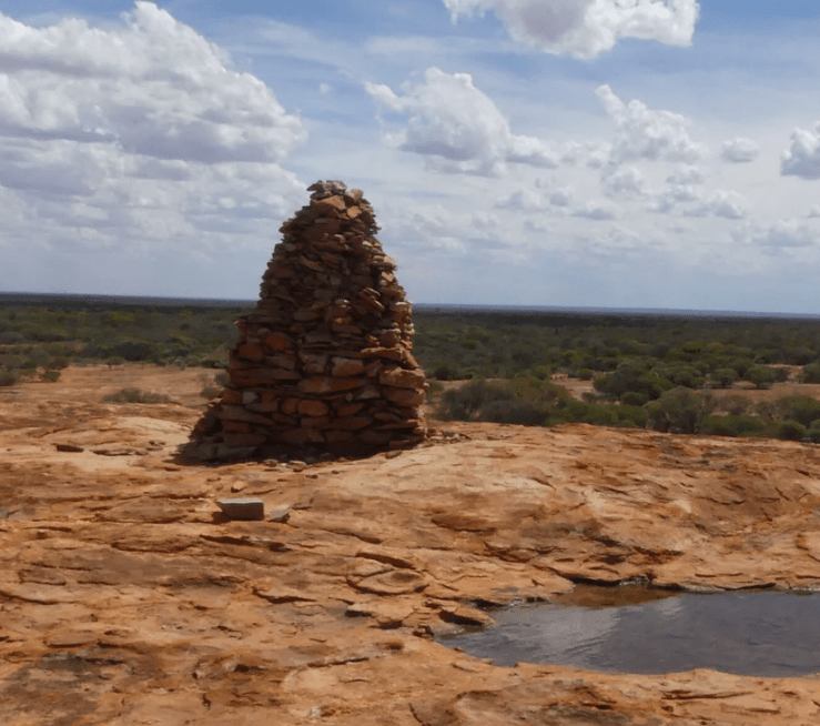
On the evening of 16 October 1875, a expeditionary group led by Ernest Giles, was attacked. He wrote about the incident in his book originally published in 18892. If you visit the area, you will see a cairn that was erected in Giles’ memory.
The 1904 Electoral Roll for Ullaring records 16 souls – 9 of them miners and 4 of them women. We also learn that there were at least two hotels in the town at the time, the Ularring Hotel (August Lichberg, Publican) and the Victoria Hotel4.
Sources
- Moya Sharp, n.d. Ularring (sic) Cemetery. Imaged retrieved from https://outbackfamilyhistory.com.au/records/record.php?record_id=517 on 17 Oct 2024 ↩︎
- Giles, Ernest, Australia Twice Traversed, Hesperian Press, Carlisle, Western Australia, 1995, pp 291-295. Reprint of 1889 edition published by Low, Marston, Searle and Rivington, London ↩︎
- Keith & Frances Thompson, 2024. All Over Australia : Ularring Rock. Image retrieved on 17 Oct 2024 from https://alloveraustralia.com/post/ularring-rock/ ↩︎
- Moya Sharp, n.d. Ullaring 1904 Electoral Roll Western Australia. Retrieved from https://outbackfamilyhistory.com.au/records/record.php?record_id=518&town=Ullaring on 17 Oct 2024 ↩︎
