Christine Harris (2026)
Demographics
Region: Peel
LGA: Waroona
Industry: Timber Mill, Aluminium Refinery
Other Names:Waigerup, Waigeerup
Open Street Map: -32.92888, 115.87366
What3Words: ///logging.science.arch
Settled: 1896
Gazetted: 1899
Current Status: Refinery opened in 1984 and current population is 52.1
Abstract
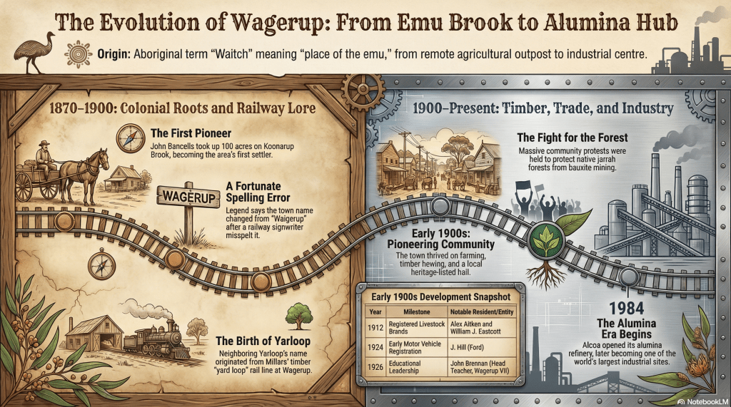
Wagerup, a small town in Western Australia’s Peel region, was established by pioneer farmers like John Bancells in 1870, and the town originally thrived on agriculture and the timber industry, supported by the arrival of the South Western Railway in the 1890s. The town profile traces the social and economic shifts from a quiet rural community to an industrial centre, marked by the 1984 establishment of the Alcoa alumina refinery. This industrialisation serves as a focal point for discussing the complex interplay between economic development and environmental preservation. The account details the political and environmental tensions of the 1970s, where local activism challenged bauxite mining in jarrah forests, and the subsequent social impact of refinery operations, including documented health concerns from residents. By weaving together the stories of resilient early settlers, the clerical errors that named the town, and the modern challenges of industrial emissions, the article provides a comprehensive view of Wagerup’s transition. Ultimately, Wagerup remains a locality defined by its industrial prowess, yet its dwindling residential population highlights the long-term impact of living in the shadow of heavy industry.
History
The story of Wagerup is one of profound transformation, moving from an ancient landscape teeming with wildlife to a pioneer farming community, and eventually into one of the most significant industrial localities in Western Australia. Located in the Peel region along the South Western Highway, Wagerup sits between the towns of Waroona and Harvey, roughly 124 kilometres south of Perth. Its history is a complex weave of economic ambition, social resilience, and environmental conflict.2 3 4
Earliest Days and the Noongar Heritage
Long before European boots touched the soil, the area was part of the traditional lands of the Noongar people. The name “Wagerup” itself is deeply rooted in this Aboriginal heritage. Derived from the term “Waitch,” meaning “the place of the emu,” the name was originally applied to a local brook. This original nomenclature, often spelt as Waigerup or Waigeerup in early colonial records, serves as a permanent linguistic marker of the emus that once thrived in the lush jarrah forests and plains of the scarp.5 6
Pioneer Settlement and Rural Industry (1870–1890)
The era of European settlement began in earnest in 1870 when John Bancells took up 100 acres on what was then called Koonarup Brook. Bancells, recognized as the district’s first settler, did not reside on his block until 1874 or 1875. The brook he settled on was eventually renamed Bancells’ Brook in his honour.
In these early years, Wagerup was an isolated outpost. There were no railways, and travel between Perth and Bunbury was conducted over a treacherous sand track. Economic activity was purely agricultural and pastoral, with settlers like William Joseph Eastcott (who married one of Bancells’ daughters) settling adjacent to his father-in-law in 1886. The Aitken family, led by Alexander and his sons Isaac and James, arrived in 1890, settling on the Wagerup Brook. They were soon followed by the Pusey and Eastcott families in 1893.
Pioneer life was dictated by the landscape. These families operated on a subsistence level, supplemented by small-scale dairy farming and repairing machinery for neighbours. Socially, the community was tight-knit; the first Catholic Mass in the district was celebrated in 1890 within the home of the Eastcotts by Father Brady.7 8
Transport Evolution and the Naming Error
Before the railway, communication with the outside world was maintained via a four-horse coach driven by John McKernan. This coach carried more than just mail; it transported flour, sugar, possum skins, and kangaroo carcasses for soup making between Yarloop and Bunbury.9
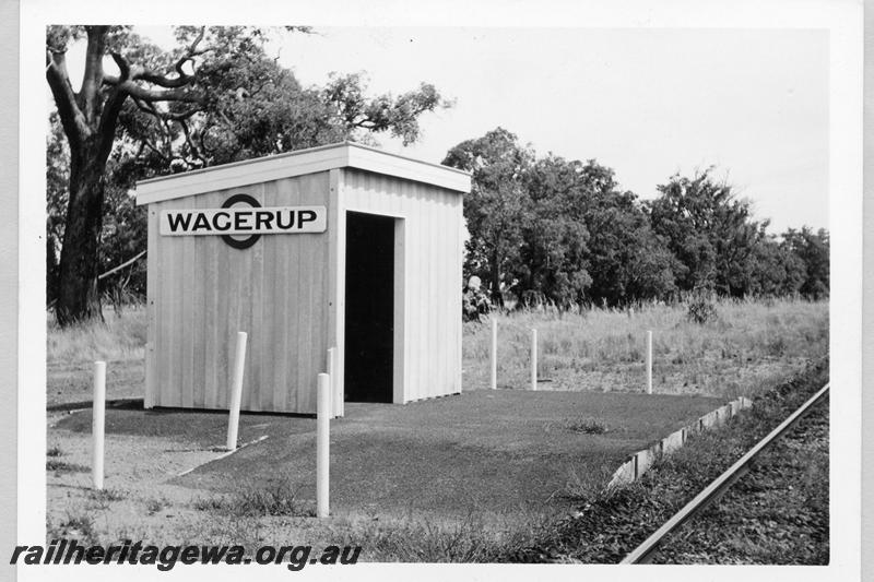
The landscape changed forever with the construction of the South Western Railway, which reached the area in 1893. A siding was established near the Aitken farm on Waigerup Brook. It was during this period that the modern spelling of the town was born from a simple human error. Local legend dictates that the man tasked with painting the sign for the railway platform left out the letter “I” from Waigerup. By the time the townsite was officially gazetted in 1899, the misspelt version, Wagerup, had been formally adopted.10 11 12
The Timber Boom (1895–1920)
The late 19th century saw Wagerup become a gateway to the timber-rich hills of the scarp. In 1895, Millar Bros amalgamated with smaller operators and opened a significant mill operation in Wagerup. They constructed tramlines into the hills to a location known as Klondyke to extract jarrah logs.
This industrial expansion brought new characters to the town, including company managers like Teesdale Smith and mill managers like Reg Driver. The timber industry was the primary economic engine, leading to the development of nearby Yarloop (named after a “yard loop” in the railway line). Wagerup functioned as the educational and social hub for these workers; before Yarloop built its own school, children from across the district attended the Wagerup school on the Perth-Bunbury road.
Community spirit was exemplified by the Reverend Thomas Jackson, who in 1910 single-handedly built the Anglican All Saints Church. Tragically, during the church’s consecration in November 1910, Jackson collapsed and died of heart failure in the arms of a parishioner while carrying the Bishop’s staff.14
Environmental Awakening and the Alcoa Shift (1970–1984)
The mid-20th century saw a decline in traditional timber milling, but the 1970s brought a new and controversial economic prospect: bauxite mining. The proposal by Alcoa to build a massive alumina refinery at Wagerup sparked fierce political and environmental conflict.
Groups such as the Campaign to Save Native Forests and the South West Forests Defence Foundation challenged the venture, citing concerns over the destruction of jarrah forests and the impact on local water resources. These protests represented one of the earliest major environmental political movements in Western Australia, pitting the economic promise of industrial development against the preservation of the natural heritage.
Despite the opposition, the Wagerup Alumina Refinery commenced operations in 1984. This marked the town’s definitive shift from a rural settlement to a high-tech industrial hub.15 16
Public Health and Political Tensions (1984–Present)
While the refinery became the town’s economic cornerstone, it brought significant social and health challenges. For decades, Wagerup and Yarloop residents, along with refinery workers, reported chronic illnesses. These included respiratory irritation, nosebleeds, headaches, and nausea. National media, including the ABC’s Four Corners, highlighted these concerns, though Alcoa maintained that no formal causal link was established.
In 2006, the political landscape shifted again when the state government granted Alcoa permission to expand the refinery into the largest of its kind in the world. This decision was met with further resistance, including legal challenges in the Supreme Court by residents from neighbouring Yarloop. These events had a hollow-out effect on the town’s social fabric, as many long-term residents chose to leave the area due to health concerns or through Alcoa’s land-purchasing programmes.18
Current Status of Wagerup
Today, Wagerup is more an industrial locality than a traditional town. The 2021 Census recorded a population of just 52 people (down from earlier records of 31 in some locality guides). The town offers very few amenities; there are no dining options or accommodation within the locality itself, with visitors instead directed to nearby Waroona or Harvey.19 20
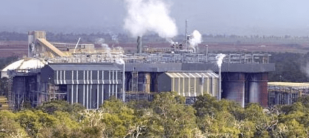
The landscape is dominated by the refinery and its access roads, such as Wagerup Alumina Refinery Access Rd and Zig Zag Rd. While nature enthusiasts still visit the surrounding jarrah forests for bushwalking, the town’s identity is now inextricably linked to industrial processing. Wagerup remains a site of “industrial prowess,” but its story serves as a poignant commentary on the cost of progress and the fragile balance between human industry and environmental health.21 22
Timeline
- 1870: John Bancells takes up the first 100-acre block on Koonarup Brook.
- 1874/75: Bancells becomes the first resident settler in the district.
- 1886: William Joseph Eastcott settles on the block adjacent to Bancells.
- 1890: Alexander Aitken and sons settle on Wagerup Brook; first Catholic Mass held in the Eastcott home.
- 1893: The South Western Railway officially opens, bringing a siding to the area.
- 1895: Millar Bros timber company opens operations in Wagerup.
- 1896: The clerical error by a sign painter leads to the modern “Wagerup” spelling.
- 1899: The Wagerup townsite is officially gazetted.
- 1910: Reverend Thomas Jackson single-handedly builds All Saints Anglican Church and tragically dies during its consecration.
- 1921: Millars Timber and Trading Co. erects Australia’s only horizontal band saw at the local yards.
- Mid-1970s: Large-scale community protests arise against bauxite mining and the construction of the refinery.
- 1984: The Alcoa Alumina Refinery begins operations.
- 2005: ABC’s Four Corners documents resident health concerns regarding refinery emissions.
- 2006: Government permission is granted to expand the refinery to the largest in the world.
- 2016: Waroona-Yarloop bushfire destroys homes and the old Wagerup Post Office
- 2021: Census records show a dwindled locality population of 52 residents.
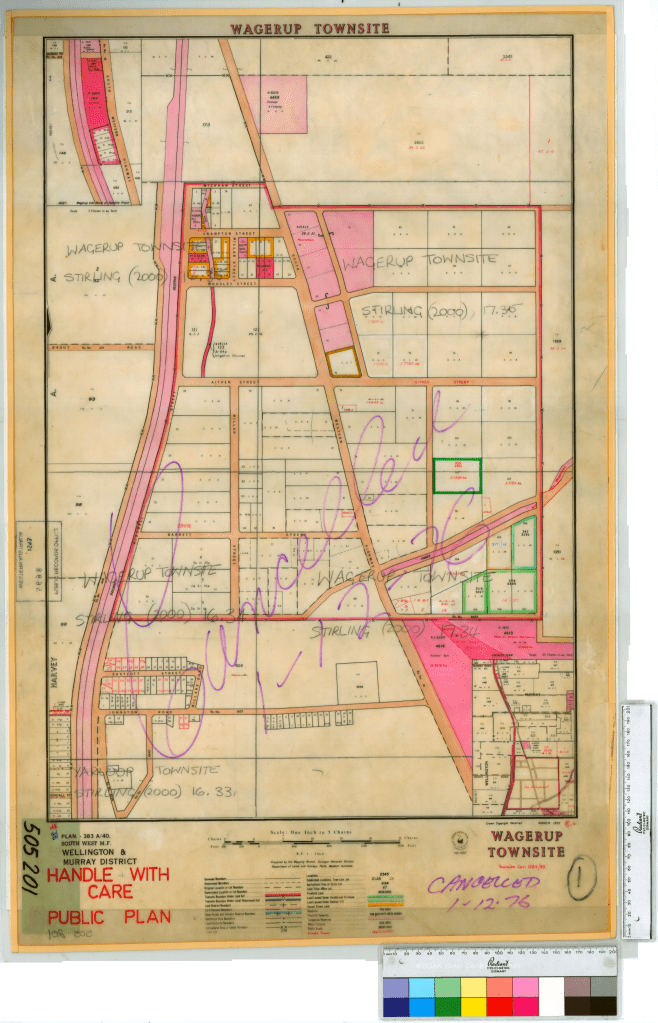
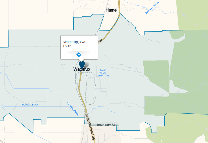
Map
Sources
- Australian Bureau of Statistics, 2021. 2021 Census All persons QuickStats: Wagerup. Retrieved 14 Feb 2026 from https://www.abs.gov.au/census/find-census-data/quickstats/2021/SAL51499 ↩︎
- wiki Australia, n.d. Guide to Wagerup. Retrieved 14 Feb 2026 from https://wikiaustralia.com/destination/wagerup/ ↩︎
- Whereis, n.d. Wagerup, WA 6215. Retrieved 14 Feb 2026 from https://www.whereis.com/wa/wagerup-6215 ↩︎
- Wikipedia, 2022. Wagerup, Western Australia. Retrieved 14 Feb 2026 from https://en.wikipedia.org/wiki/Wagerup,_Western_Australia ↩︎
- ibid ↩︎
- wiki Australia: refers to early variations on the name ↩︎
- Harvey History Online, 2016. Potted Histories: Early Days of Wagerup and Yarloop. Retrieved 14 Feb 2026 from https://www.harveyhistoryonline.com/?p=3128 ↩︎
- Shire of Waroona, n.d. St Patrick’s Church. Retrieved 14 Feb 2026 from https://www.waroona.wa.gov.au/st-patricks-church.aspx ↩︎
- Harvey History Online: refers to pre-railway Waigerup ↩︎
- ibid: refers to the coming of the railway ↩︎
- Higham, Geoffrey (2015). Back Along The Line: An historical gazetteer of railway stations, sidings and related facilities along Western Australian railway lines. p.9, 20. Retrieved 14 Feb 2026 from https://www.geoproject.com.au/News/Gaz_5_rail_ordered_08July2016.pdf ↩︎
- Wikipedia: refers to original name and gazetted name ↩︎
- Rail Heritage WA, n.d. P09396: Wagerup, shelter shed, platform, nameboard, view from rail side, SWR line. Retrieved 14 Feb 2026 from https://www.railheritagewa.org.au/archive_scans/displayimage.php?pid=6005 ↩︎
- Harvey History Online: refers to the ongoing development of the town and the establishment of the Anglican church ↩︎
- Wikipedia: refers to alumina refinery and environmental issues ↩︎
- wiki Australia: refers to alumina refinery and environmental issues ↩︎
- State Records Office of WA, 2015. Wagerup [Tally No. 505201]. Retrieved 14 Feb 2026 from https://archive.sro.wa.gov.au/index.php/wagerup-tally-no-505201-1593 ↩︎
- Wikipedia: refers to reported health issues and legal challenges ↩︎
- ibid ↩︎
- wiki Australia: refers to the current town of Wagerup and its facilities ↩︎
- ibid ↩︎
- Wikipedia: refers to “industrial prowess” and “natural beauty” ↩︎
- Whereis, n.d. Wagerup, WA 6215. Retrieved 14 Feb 2026 from https://www.whereis.com/wa/wagerup-6215 ↩︎
Further Reading
- Hunte, H.E. (chair) (1978) Report by the Steering Committee on Research into the Effects of Bauxite Mining on the Water Resources of the Darling Range, September 1978. Perth, WA: Dept. of Industrial Development, Western Australia, ISBN0-7244-7841-8
- Lines, William J. (2006) Patriots: defending Australia’s natural heritage St Lucia, Qld: University of Queensland Press. ISBN0-7022-3554-7
- Working Groups of Technical Review Committee to Hunt Steering Committee and Kelsal Steering Committee. (1976) Research into the effects of bauxite mining in the Darling Range. Research into the effects of woodchipping in the Manjimup area, reports of Working Groups of Technical Review Committee to Hunt Steering Committee and Kelsall Steering Committee, Perth, WA: Dept. of Conservation & Environment.
