When we started this project we had a list of about 250 Ghost Towns. It didn’t take very long before the list began to grow. As at today’s update, we have 628 (with a couple that we are holding in reserve pending confirmation of their ghostly status).
All three lists have been updated (alphabetical listing, by Region, by LGA) and the changes have been marked in the Alpha and LGA lists. There have been lots added with this update, so check it out! If you want to see what is new in your area, I suggest checking the LGA list out first, as this will tell you how many communities have been identified around you, and particularly will highlight where new entries have been added. Just remember when looking at the number of communities this includes a line entry for any known alternative names of a particular community, so that could mean that the same community is listed twice, three times or even more depending upon how many times it has changed its name over time.
A lot of new towns came to light following the broadcasts on ABC Radio and we are really grateful to everyone for their interest, enthusiasm and participation. But every day we are getting new leads, so keep checking back to see the updates and subscribe to this blog to be notified when there’s a new post.
If you want to add a ghost town or abandoned community to the list, please contact us.
As I have been researching ghost towns, I have often come across the phrase “state battery”. Without actually taking the time out to discover what this was, ideas that flittered through my mind included some sort of power generation facility or a method of providing fresh eggs and chickens in the outback.
Today is the day. I have found out what a state battery is, and I’m going to share it here because there could be others like me who have no clue!! And please, if I have made any incorrect assumptions or conclusions, tell me!!
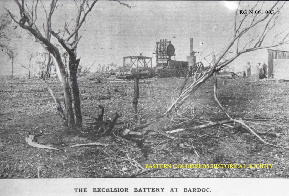
Photo is from the Eastern Goldfields Historical Society’s digitized collection of 60,000 negatives1.
In Western Australia a state battery was a government owned and operated crushing facility that crushed the ore found by prospectors and dug from small mines in the area. The Western Australian Department of Mines were the government agency responsible for their operation. Some of the batteries were only operating for one or two years, while others were in place for 5o or more years. Western Australia was the only state in Australia to provide this type of facility.
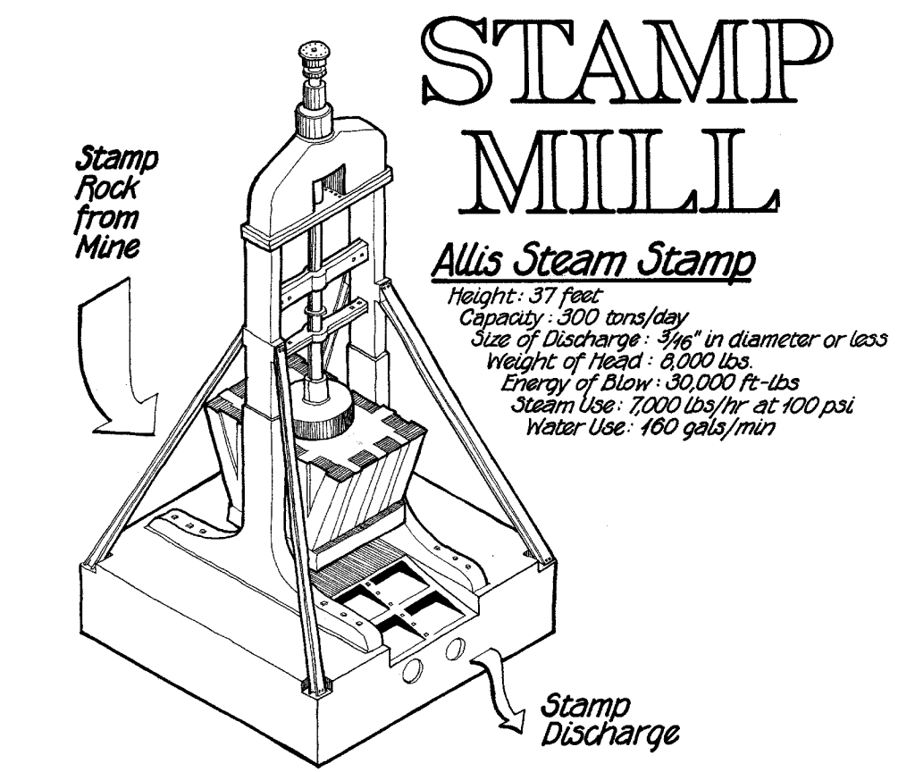
A battery (aka stamp battery, stamp mill or stamping mill) crushes ore by pounding rather than grinding. Each stamp head consists of a set of heavy steel stamps in a vertical frame. The stamp slides up and down crushing the rock. Batteries were gauged by the number of heads, hence a 10-head battery has 10 stamp heads crushing ore.
The first public battery (as they were originally known) was opened at Norsemam in 18982. Prior to this privately owned and operated batteries were the norm. In considering the legislation to establish public batteries, some last minute adjustments to the wording gave the administrators discretion to “assist” private batteries in certain cases3.
I haven’t been able to find out how many state batteries were established, but by the 1930s the total number of batteies (public and private) was close to 100, dropping to less than 50 by 1958. By 1982 a government review of state battery operations resulted in closure of all by 19874. In 1996 the battery at Ora Banda was rebuilt and reopened. Unfortunately, it never crushed any ore and in 2000 it was badly damaged by bombing and has not been rebuilt5.
As at April 2012, Wikipedia published a list of known state batteries in Western Australia (see below) but this list is believed to be incomplete. Do you know of any more? If you do please let us know at ghostswa@fhwa.org.au. While our focus, as always, is on the ghost towns, for completeness this list includes those state batteries that were located at all known sites, ghostly or otherwise!
List of State Batteries known to have existed in Western Australia
Bamboo
Laverton
Nannine
South Greenbushes
Black Range
Leonora
Niagara
Southern Cross
Bulong
Linden
Norseman
Tuckabianna
Carlaminda
Marble Bar
Ora Banda
Tuckanurra
Coolgardie
Marvel Loch
Paddington
Warriedar
Cue
Meekatharra
Paynes Find
Widgiemooltha
Darlot
Messengers Patch
Paynesville
Wiluna
Desdemona
Menzies
Pig well
Yalgoo
Devon
Mt Egerton
Pinjin
Yarri
Donnybrook
Mt Ida
Quinns
Yerilla
Duketon
Mt Keith
Randalls
Youanmi
Dumpling Gully
Mt Sir Samuel
Ravelstone – Peak Hill
Yundamindera
Kalgoorlie
Mulline
Ravensthorpe
* Mt Jackson
Kalpini
Mulwarrie
Sandstone
* Siberia
From Wikipedia article – State Batteries in Western Australia, 2012 * Updated 26 Nov 2023 with additional locations from Gone West by Geoffrey Higham.
The Western Australian Goldfields Courier, Coolgardie, WA : 1894-1898. Norseman Public Battery. 10 Sep 1898, p.23. Retrieved from http://nla.gov.au/nla.news-article251211132 on 26 Nov 2023 ↩︎
The following article was published on page 1 of The Sun newspaper on Sunday, 21 November 1909. I first stumbled across the name of Billy Frost while researching Siberia where he, along with Bob Bonner, discovered gold in 1893.
That well-known prospector, Billy Frost, the discoverer of Goongarrie, Siberia and Burtville, and the pegger out of the Premier at Kunanalling, the third lease applied for on the Coolgardie goldficlds, is again amongst us after prospecting in pretty nearly every goldfield in the world. After a long experience and many hairbreadth escapes, in which his death has been duly chronicled many times, Frost has returned, and is of opinion that Australia is “God’s own country”. Anyhow he is going to have one more try. A syndicate is being formed of 40 shares of £25 each to fix up matters. Frost gets nothing, either in cash or wages, but takes 10 fully paid up shares, which are a pure gamble. Ten further shares are held in reserve for contingencies, while 20 contributing shares, £12 10/ to be called up, are being issued. Of the latter half have been placed in Perth, and goldfielders have now an opportunity to apply for the balance, five of which have already been placed. The Government is backing the venture with camels, and all that Frost requires is tucker for a six to twelve mouths’ trip, which, in the early days he could have got in the twinkling of a star. Frost is staying with Jerry McAuliffe, prospector of the White Feather, Yerilla and other shows, but is rather diffident of being interviewed by members of the fourth, or any other, estate. He starts outback almost immediately.
BILLY FROST. (1909 November 21). The Sun (Kalgoorlie, WA : 1898 – 1929), p.1.1
It seems like Billy was a bit of a lad, and here I may be reading too much into it, but the tone of the article suggests that investing your hard earned in his new venture might be a little risky?
In 1926, in Mackinlay, Queensland, Billy was shot by Mick Ford during an argument. He is buried at Cloncurry2.
In a state that is larger than many countries around the world, you could expect to find some extraordinary stories. Stories of hardship and courage; stories of extreme wealth and extreme poverty; stories of cultural diversity and of bonds formed in adversity; stories of the building of a national identity but also stories of environmental vandalism. It is all there written in the earth. And sometimes the earth is all that is left to mark the passing of the communities that have made up the history of the state. There’s one thing that brings all these stories together – the people who lived them.
2029 will mark two significant Western Australian milestones. The first milestone is the Bicentenary of European settlement. The second is FamilyHistoryWA’s 50th Anniversary. To mark these events, the Society (FHWA) has launched a project to gather together everything we can find about the people who lived in the ghost towns of Western Australia. The project timeframe is six years. The project will be launched in 2029 to coincide with the joint celebrations.
At present the list of identified ghost towns sits at more than 500. Of these perhaps the mining towns are the best known. In the 1901 census the largest towns in Western Australia included the mining towns of Day Dawn, Kanowna, Mount Morgan, and Nannine, all of which are ghost towns today. But there were many other non-mining gazetted towns that reflect Western Australia’s history of building railway lines, a long pipeline from Perth to Kalgoorlie, timber towns (which supplied the railway sleepers), the government-initiated Soldier Settlement and Group Settlement schemes and towns that were created to service spread out farming communities.
Polish lady, Pela Behrendt came to Ewlyamartup with her husband and young daughter in 1950 from the Northam Migrant camp when her husband got a two-year contract to work on the railway. Luckily for us Pela was interviewed about her experiences in the 1990s and that interview has been digitalized by SLWA1 .
Lake Ewlyamartup 2023 by Josie Millwood
Pela found Australia in the 1950s to be a primitive place to live. Moving to Ewlyamartup, a siding on the Nyabing Katanning train line, probably reinforced that impression. The local farmers used to load their produce on the train at Ewlyamartup for transportation to Katanning and beyond.
Accommodation for Pela’s family and the other eastern European families living there consisted of tents with their own kitchen block. There was no electricity or refrigerators and drinking water was delivered once a week from Katanning. Kerosine lamps were used for lighting with heating provided by kerosine heaters. Katanning was 11 miles away. If Pela needed to go into town, she caught a ride on the school bus that passed by. Her husband used to ride a push bike into town. One of things he did in Katanning was deposit their savings into the bank. Pela was a good manager of money. She was also very resourceful. As she had brought her sewing machine from Europe, she bartered her sewing skills for fresh produce for her family. As a result, Pela rarely needed to buy milk, eggs, vegetables, or fruit and could give her husband £5 each Friday to bank, as she only needed £2 pounds, (out of his weekly salary of £7) to live on.
In 1951 Pela’s family moved away from Ewlyamartup to another railway siding, Elleker, which was closer to Albany. A few years later they were able to buy a parcel of land in Albany and and eventually built a house there. Their time in Ewlyamartup was a stepping stone for them to achieve their Australian dream.
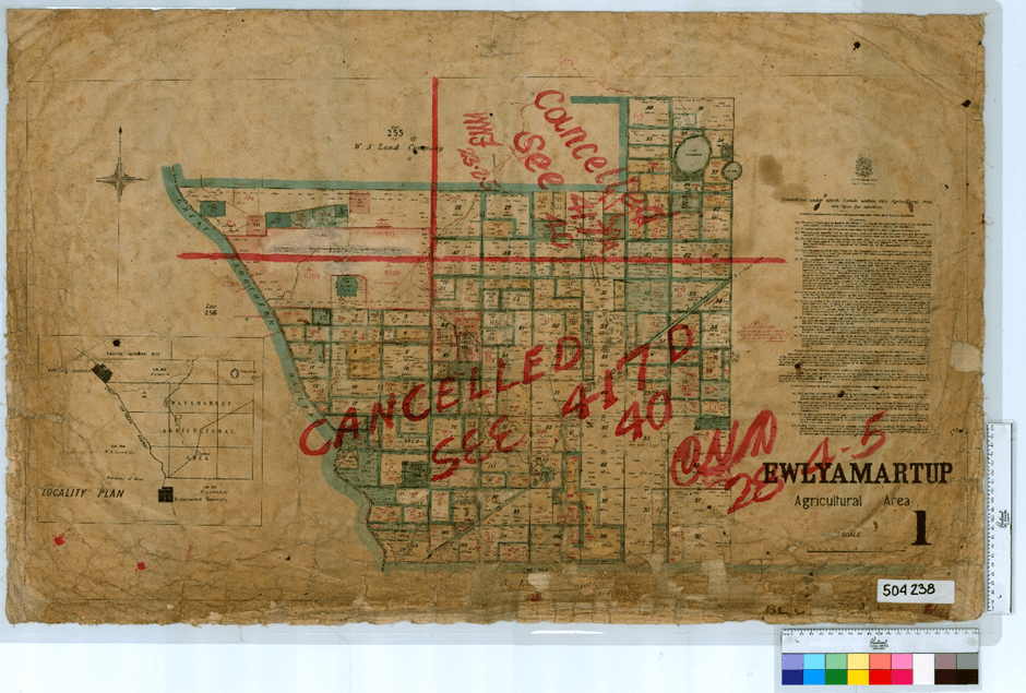
After a recent trip to Lake Ewlyamartup, where I discovered that a railway settlement with a school had previously existed by the lake, I went searching to see what I could find out about Ewlyamartup. Ewlyamartup was one of the first settled districts out of Katanning with an ambitious town plan drawn up in the 1890s. Prior to that Ewlyamartup was a significant place for the local Indigenous people, a fact that has only been acknowledged in recent years when interpretive signage has been placed near the restored lake. As the Ewlyamartup area was settled by farmers there was a need for a school. The first school opened in 1905 but closed in 1908. It reopened in 1912 and remained open until the end of 19432.
Today I have added 36 new Towns to the alphabetical listing on the website. Over the next few days, I will also add them to the “By Region” and “By LGA” listings so that there’s complete functionality.
The towns include:
Candlelight
Emu Hill
Hester
Holleton
Kukerin
Mount Palmer
Toolibin,
…and lots more!
Check the list to see if your town is included!! Contact us if it is missing or if we have something wrong.
For a project of this complexity, it is important to get the processes correct right from the beginning. To do this, we need to test our tools and work flows on real examples. So the Project team have chosen four communities that represent different types of settlement, different industries, different population profiles, so that we can work out the bugs before the full teams start work.
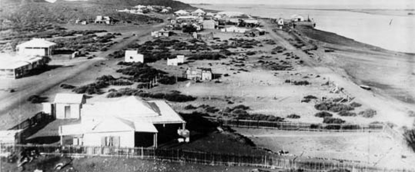
Before Broome, Cossack, at the mouth of the Harding River in the Pilbara, was the hub of the pearling industry in Western Australia. Originally named Tien Tsin in 1863, the name was changed to Cossack in 18711 and the townsite was officially declared in 1872. The area is also known by the traditional name Bajinhurrba.
Apart from the pearling industry, it was a major port for the Pastoral industry and, in the 1880s, hundreds of prospectors arrived there searching for gold in the Pilbara. The major buildings in area during this period included a stone wharf, the bonded store and customs house, a post and telegraph office, police barracks, court house, school, tramway and a selection of stores. Chinese, Malays, Japanese and Afghans all came to the area, and many of them, including prisoners, were involved in the construction of the Jarman Island Lighthouse2. By the 1890s, Cossack was a thriving community. However, on 4 April 1898 a major cyclone destroyed much of the town34. By 1900 the pearling fleet had moved north to Broome and by 1910 the municipality was dissolved.
That wasn’t the end of the story. In 1910, a site on Butcher’s Inlet was gazetted as a quarantine reserve for a leprosarium and this remained in operation until 1931 when the remaining fourteen patients were transferred to Darwin5.
People continued to live in Cossack in small numbers until after World War II, but by 1950 it had become a ghost town. The remaining buildings have now been restored, and Cossack has become something of a tourist destination in recent years.
Goongarrie
In 1893 a group of goldminers named Frost, Pickersgill, Bennett and Cahill discovered gold in an area6 about 84Km north of Kalgoorlie. Initially known as 90 Mile (the estimated distance to Coolgardie) or Roaring Gimlet (the sound of the wind blowing through the Gimlet trees)7, the town was gazetted in 1895. The town was located on the railway line that ran between Menzies and Kalgoorlie.
At its peak the town had a water supply, police presence, transport services (coach and later rail), post and telegraph, hotels and a boarding house, a miner’s institute including a library, and a full range of retail including two restaurants.
By 1903 the population was down to 66 while the 1921 postal directory contained only 25 entries8. Eventually the town site became first a pastoral station (also known as Goongarrie) and now part of the Goongarrie National Park.
Nugadong
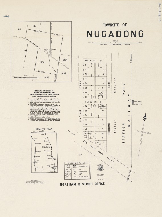
The settlement at Nugadong grew up around a railway siding on the Wongan Hills to Mullewa Railway in 19139. The Gregory brothers first explored the area in 1846 for agricultural and pastoral potential but no settlement took place for many year10s. In 1894 the Midland Railway, linking Perth and Geraldton, was completed and this brought settlers.
Our research into Nugadong hasn’t gone far yet, but we do know that, in 1922, Arthur Jenner and Tom Hodgson took up war service land there, as did Harry & Jesse Atkinson in 1948 who raised a family of six on a farm there11.
Until the 1970s there was a race track called Nugadong in the area, and the Dalwallinu air field is located by the Nugadong Rail Siding.
The town of Dalwallinu was originally called South Nugadong12.
Goodwood Timber Mill
The Goodwood Timber Mill was chosen as a pilot site to represented the many Timber communities in our list. It is proving to be extremely ghostly. What do we know (or think we know) so far – not a lot!
Most records refer to the settlement simply as “Goodwood”.
We have some births registered at Goodwood between 1885 and 1888
We have a drowning in 1886
On 11 March 1891, J. A. Evans advertised “All houses, buildings and fences at Goodwood Saw Mill” for immediate sale13.
That’s about it. But the search is ongoing. And, after all, we did want to know the sort of challenges we would face during the project, didn’t we!
One of the question we are frequently asked is “What is meant by the term “Ghost Town”? What follows is an attempt to answer that question.
A ghost town is a term used to describe a once-thriving or populated settlement or community that has been largely abandoned and has few or no permanent residents remaining. These towns typically experienced a decline in economic activity or some other significant change in circumstances that led to their abandonment. There are various reasons why a town may become a ghost town, including:
Economic downturn: Many ghost towns were originally established as mining towns or as centers of economic activity linked to industries like mining, timber, agriculture, or manufacturing. When these industries declined or collapsed, people left in search of better opportunities elsewhere.
Resource depletion: In cases where a town’s existence was tied to the extraction of a finite resource, such as coal or minerals, once those resources were exhausted, the town often declined and was abandoned.
Changes in transportation: The construction of new transportation routes, such as highways or railroads, can bypass existing towns, leading to their economic isolation and eventual decline.
Project completion: In Western Australia many of our ghost towns grew up to support the development of huge infrastructure projects, such as the Goldfields Pipeline, the Trans-Australian Railway, and the construction of water and power infrastructure. When the projects were completed, the people moved on to the next one.
Government actions: In some instances, government policies or decisions, such as the establishment of new national parks or the relocation of communities for various reasons, have resulted in towns being abandoned.
Ghost towns can vary in size and historical significance. Some have been well-preserved as historical landmarks, offering a glimpse into the past, while others have deteriorated or disappeared entirely. People may visit ghost towns for tourism, historical research, or as a way to experience a unique and often eerie atmosphere associated with these abandoned places.
Some ghost towns aren’t towns at all. They were communities that grew up organically for many different reasons, such as telegraph stations, rail sidings or timber mills. Some of these communities went on to become towns and even cities, while some just disappeared.
As we work through the project, we will be assessing every community on a case-by-case basis. You can help us. Tell us what you know about these places and help us to make the right decision.