This document lists all communities included in our project (to date) by Administrative Region and Local Government Authority. At the bottom of the list, you can find a list of communities that are still being researched – here.
As at 24 Oct 2025, we have 612 identified ghost towns in 105 local government areas out of a total of 137 LGAs. We have also identified 818 alternate names for those 612 towns.
Last update to the list was made on
- South West
- Wheatbelt
- Beverley
- Brookton
- Bruce Rock
- Chittering
- Corrigin
- Cuballing
- Cunderdin
- Dalwallinu
- Dandaragan
- Dowerin
- Dumbleyung
- Kellerberrin
- Kent
- Koorda
- Kulin
- Lake Grace
- Merredin
- Moora
- Mount Marshall
- Mukinbudin
- Narrembeen
- Narrogin
- Northam
- Nungarin
- Pingelly
- Quairading
- Tammin
- Toodyay
- Trayning
- Victoria Plains
- Wagin
- Wandering
- West Arthur
- Westonia
- Wickepin
- Wongan-Ballidu
- Wyalkatchem
- Yilgarn
- York
- Still undergoing research
Gascoyne
The Gascoyne region is one of the nine administrative regions of Western Australia. It is located in the northwest of Western Australia, and consists of the local government areas of Carnarvon, Exmouth, Shark Bay and Upper Gascoyne. For more information about the Gascoyne region of Western Australia, please visit the Gascoyne Development Commission website and Wikipedia.
Carnarvon
The Shire of Carnarvon is a local government area in the Gascoyne region of Western Australia about 900Km north of Perth. For more information about the Shire of Carnarvon, please visit the city’s website and Wikipedia.
| Phase | Name | Other Name/s |
|---|---|---|
| 24 | Galilea Mission | |
| 13 | Gladstone Bay | |
| 9 | Yankee Town |
Shark Bay
The Shire of Shark Bay is a local government area in the Gascoyne region of Western Australia. For more information about the Shire of Shark Bay, please visit the city’s website and Wikipedia.
| Phase | Name | Other Name/s |
|---|---|---|
| 16 | Bernier Island | |
| 16 | Dorre Island | |
| 19 | Faure Island | |
| 18 | Hamelin Pool | Flagpole Landing |
Upper Gascoyne
The Shire of Upper Gascoyne is in the Gascoyne region, inland from Carnarvon and about 1,000 kilometres north of Perth. The Shire has an area of 57,939 square kilometres, much of which is uninhabited land or sparsely vegetated sheep station country. The seat of government is the town of Gascoyne Junction. In 2021 the population was 170, 56% of whom identify as Aboriginal. If you want to know more about the Upper Gascoyne, please visit the city’s website and Wikipedia.
| Phase | Name | Other Name/s |
|---|---|---|
| Bangemall | Bangemall Wayside Hotel Cobra Station Bangemall Police Station Thomas River Police Station Euranni Hotel Euranni Wayside Hotel | |
| Mount Clere | Mount Clere Police Station Mount Clere Station Mt Clere Mount Clere Well |
Goldfields-Esperance
The Goldfields-Esperance regions is one of the nine administrative regions of Western Australia. It is located in the south eastern corner of Western Australia and covers an area of 770,448km2. It includes the Little Sandy Desert and the Gibson Desert in the north and the Great Victoria Desert in the south. It also includes more than half of the ghost towns we have identified to date.
For further information about the regions visit the Goldfields-Esperance Development Commission and Wikipedia.
Coolgardie
The Shire of Coolgardie is a local government area in the Goldfields-Esperance region of Western Australia. For more information about the Shire of Coolgardie, please visit the city’s website and Wikipedia.
| Phase | Name | Other Name/s |
|---|---|---|
| 12 | 45 Mile | |
| 20 | Bonnie Vale | Bonnievale Bonny Vale 11 Mile |
| 22 | Boorabbin | |
| 25 | Bullabulling | |
| 23 | Burbanks | |
| 9 | Calooli | Kalooli Calooli Railway Siding |
| 2 | Carbine | Carbine Gold Mind |
| 5 | Celebration City | Celebration |
| 14 | Dunnsville | Wealth of Nations Gold Mine |
| 8 | Fly Flat | Bayley’s Reward Mine |
| 2 | Higginsville | Two Boys |
| 6 | Kintore | |
| 7 | Kunanalling | 25 Mile Coonalion Coolalion Kunalling Connanalling Coonanation |
| 24 | Kundana | Kindana |
| 13 | Kurrawang | |
| 21 | Larkinville | Alyns Railway Siding |
| 4 | Londonderry | Golden Hole Mine |
| Montana | ||
| 23 | Moondine | Smithfield #2 |
| 27 | Mungari | Mungarrie |
| 10 | Spargoville | |
| 14 | St. Ives | Ives Find |
| 17 | Toorak | |
| 16 | White Flag | 21 Mile Twenty-one Mile |
| 11 | Widgiemooltha | Widgemooltha |
| 15 | Woolgangie |
Dundas
The Shire of Dundas is a local government area in the Goldfields-Esperance region of Western Australia. For more information about the Shire of Dundas, please visit the city’s website and Wikipedia.
| Phase | Name | Other Name/s |
|---|---|---|
| 4 | Buldania | Bedomia |
| 23 | Dundas | |
| 8 | Eucla | Eucla Telegraph Station |
| 15 | Forrest Railway Station | |
| 9 | Haig | Haig Railway Siding |
| 10 | Loongana Railway Siding | |
| 12 | Mundrabilla | Mundrabilla Railway Siding |
| 27 | Nurina | Nurina Railway Siding |
| 11 | Princess Royal |
Esperance
The Shire of Esperance is a local government area in the Goldfields-Esperance region of Western Australia. For more information about the Shire of Esperance, please visit the city’s website and Wikipedia.
| Phase | Name | Other Name/s |
|---|---|---|
| 10 | Cascades | |
| 16 | Circle Valley School | |
| 21 | East Circle Valley School | |
| 26 | East Dowak School | |
| 22 | Grass Patch | Grass Patch School |
| 19 | Israelite Bay | Israelite Bay Telegraph Station Israelite Bay Jetty |
| 26 | Kumarl | Kumarle |
| 6 | Red Lake | Red Lake School |
| 15 | Rich Meadows School | |
| 14 | Salmon Gums School | |
| 13 | Treslove | Truslove |
| 24 | West Scadden | West Scadden School |
Kalgoorlie-Boulder
The City of Kalgoorlie-Boulder is a local government area in the Goldfields-Esperance region of Western Australia. Given the prevalence of mining settlements in our list, it will come as no surprise to anyone that there are three dozen communities in this listing.
Interesting fact: the City of Kalgoorlie-Boulder is larger in area than the country of Portugal. 1
For more information about the City of Kalgoorlie-Boulder, please visit the city’s website and Wikipedia.
| Phase | Name | Other Name/s |
|---|---|---|
| 11 | Balagundi | Ballagundi |
| 25 | Balgarri | 42 Mile Forty-two mile Fortytwo mile |
| 18 | Bardoc | Wycheproof Gold Mine |
| 11 | Binduli | |
| 16 | Black Flag | |
| 22 | Boorara | |
| 20 | Broad Arrow | Kurawah |
| 23 | Brown Hill | |
| 5 | Bulong | I.O.U. Lake Yindarlgooda Yindarlgooda |
| 10 | Carnage | |
| Corsair | ||
| 20 | Curtin | Curtin Railway Siding |
| 15 | Deakin Railway Siding | |
| Dingbat Flats | Dingbat Well No.1 Dingbat Well No.2 Dingbat Well No.3 | |
| 3 | Feysville | |
| 13 | Gindalbie | Whitehead’s Find Vosperton |
| 13 | Gippsland | Hayes New Find The Gippsland Limited South Gippsland Gippsland & Northern Co-op |
| 27 | Goddards Railway Siding | Goddards Railway Siding Goddard Goddard’s Creek Ponton Creek |
| 23 | Gordon | |
| 25 | Grants Patch | Grant’s Patch |
| 25 | Guddara | Paddington Sore Foot Rush |
| Gunga | Old Gunga Gunga Railway Siding | |
| Hampton Plains | Glock 48 Wollubar Dam Woolubar Dam | |
| 18 | Kallaroo | Kalaroo |
| 9 | Kalpini | |
| 13 | Kamballie | |
| 4 | Kanowna | White Feather Cement Workings |
| 17 | Karonie | Karonie POW Interment Camp |
| 6 | Kurnalpi | Mulgabbie Maori Gold Mine |
| 17 | Lakeside | |
| 19 | Lakewood | |
| 18 | Mount Monger | Mt Monger |
| Mount Shea | Mt Shea | |
| 18 | Mulgarrie | Haye’s Find Hayes Find Hit or Miss |
| 5 | Naretha | Naretha Railway Siding 205 Mile Camp |
| 9 | Ora Banda | |
| 12 | Parkeston | Parkeston Railway Siding Parkston Railway Siding |
| 10 | Reid | Reid Railway Siding |
| 16 | Scotia | Sutherland’s Siding #2 |
| 14 | Siberia | Waverley |
| 8 | Smithfield | Smithfield (1st Site) Smithfield (3rd Site) 2 |
| Taurus | Taurus Dam | |
| 15 | Trafalgar | |
| 24 | Wilban | Wilban Railway Siding |
| Windanya | Windania | |
| 7 | Zanthus |
Laverton
The Shire of Laverton is a local government area in the Goldfields-Esperance region of Western Australia. It is located almost 1,000Km north east of Perth. For more information about the Shire of Laverton, please visit the city’s website and Wikipedia.
| Phase | Name | Other Name/s |
|---|---|---|
| 15 | Beria | Lancefield Lancefield Gold Mine Lancefield Hotel |
| 15 | Blamey | Blamey Railway Siding |
| 11 | Boondaroo | Boondaroo Railway Siding Boonderoo |
| Box Creek | Box Soak | |
| British Flag 3 | ||
| 14 | Burtville | Meriola |
| 19 | Chifley | Chifley Railway Siding |
| 16 | Childe Harold | Child Harold |
| 4 | Coonana | Coonana Railway Siding |
| 27 | Cox’s Find | Coxs Find |
| 10 | Duketon | Duketon Well Lauriston Mine Golden Spinifex Mine Rose of Persia Walleroo The Patch mine |
| 22 | Erlistoun | Erlistown Borodale Creek Mistake Creek 29 Mile The Erlistoun Little Doris Erliston |
| 21 | Euro | |
| 13 | Golden Ridge | Golden Ridge Railway Siding Waterfall |
| 24 | Kitchener | Kitchener Railway Siding |
| 9 | Mount Margaret | Kalgara Mount Margaret Aboriginal Mission Mt Margaret Mt. Margaret |
| 12 | Mount Morgans | Mount Morgan Mt Morgans Mt Morgan Morgans Morgan |
| 7 | Mulga Queen | Nurra Kurramunoo |
| 23 | Randalls Railway Siding | |
| 17 | Windarra | Mount Windarra Mt Windarra |
Leonora
The Shire of Leonora is a local government area in the Goldfields-Esperance region of Western Australia. It is located almost 830Km north east of Perth. For more information about the Shire of Leonora, please visit the city’s website and Wikipedia.
As at 23 Oct 2025, we have identified 26 ghost towns in the Shire of Leonora, with a further 40 alternate names that must also be researched.
| Phase | Name | Other Name/s |
|---|---|---|
| 4 | 4 Mile | |
| 17 | Agnew | |
| 5 | Bummers Creek | Bummer’s Creek Quataara Mia Katara |
| 25 | Darlot | Woodarra Lake Darlot |
| 12 | Desdemonia | Desdemona |
| 21 | Doyle’s Well | Doyles Well Cutmore’s Well |
| 23 | Eulamina | Anaconda |
| 2 | Gwalia | Sons of Gwalia |
| 6 | Kathleen | Kathleen Valley |
| 10 | Kundip 4 | Coondip Harbour View |
| 7 | Kurrajong | Currajong Diorite King |
| 13 | Lawlers | |
| 27 | Melita | |
| 26 | Mertondale | |
| 3 | Mount Malcolm | Malcolm Mt Malcolm |
| Murrin Murrin | ||
| 20 | Pendinnie | Pennyweight Point |
| Pig Well | ||
| 11 | Poison Creek | |
| 19 | Pykes Hollow | Pikes Hollow Pyke’s Hollow, Pyke Hollow Nunyarra Pike Well |
| Redcastle | Redcastle Reward Redcastle Well #1 Redcastle Well #2 Redcastle Well #3 | |
| 15 | Sir Samuel | Samuel Mount Sir Samuel Mt Sir Samuel |
| 16 | Teutonic Bore | |
| 8 | Vivien | Harris |
| 25 | White Hope | |
| 18 | Yundamindera | Eucalyptus Yundermindera Yundaminera Yundermindra Granites The Granites Yunderamindera Treasure East Pososi Gold Mine |
Menzies
The Shire of Menzies is a local government area in the Goldfields-Esperance region of Western Australia. North of Kalgoorlie, it covers an area of 124,635 square kilometres. For more information about the Shire of Menzies, please visit the city’s website and Wikipedia.
As at 23 Oct 2025, we have identified 24 ghost towns in the Shire of Menzies, with a further 38 alternate names that must also be researched.
| Phase | Name | Other Name/s |
|---|---|---|
| 9 | 14 Mile | |
| 8 | 4 Mile | |
| 27 | Batavia | |
| 24 | Butterfly | Blue Butterfly Golden Butterfly |
| 18 | Callion | Speakman’s Find Speakmans Find |
| 13 | Comet Vale | |
| 19 | Davyhurst | Davyston Mace’s Find |
| 10 | Edjudina | Edjudina Station |
| 15 | Evanston | |
| 1 | Goongarrie | 90 Mile Ninety Mile Canegrass Canegrass Swamp Hotel Roaring Gimlet |
| 14 | Kookynie | |
| 22 | Linden | Griffithston |
| 25 | Mount Catherine | Mt Catherine |
| 15 | Mount Ida | Mt Ida Ida H Ida N Ida North Copperfield David Copperfield Mine The Copperfield |
| 12 | Mulline | |
| 16 | Mulwarrie | Mount Higgins Mt Higgins Credo Station Pastoral Lease |
| 6 | Niagara | North Niagara |
| 5 | Pinjin | Pingin |
| 16 | Tampa | Dingo Creek Dingo Rock |
| 2 | Ullaring | Ularing Ularring Ullarring |
| 17 | Wooladdie | |
| 4 | Woolgar | Yunndaga Yunndega Yundagga Yundaga |
| 11 | Yarri | New Ejudina Yarrie Station |
| 7 | Yerilla | Yerilla Station |
Ravensthorpe
The Shire of Ravensthorpe is a local government area in the Goldfields-Esperance region of Western Australia. Located halfway between the city of Albany and the town of Esperance and about 530 kilometres from Perth, the Shire covers an area of 13,551 km2. For more information about the Shire of Ravensthorpe, please visit the city’s website and Wikipedia.
| Phase | Name | Other Name/s |
|---|---|---|
| 20 | Desmond | Mount Desmond Mt Desmond |
| 10 | Fitzgerald | |
| 24 | Hatters Hill | Hatters Hill Ironcaps Mount Purchas Mt Purchas |
| 4 | Hawks Nest | Hawkes Nest Gold Mine Hawkes Nest The Pearling Grounds Hawk’s Nest |
| Phillips River |
Wiluna
The Shire of Wiluna is about 950 Km northeast of Perth. The Shire covers an area of 182,155 Km2 . To find out more check out Shire of Wiluna and Wikipedia.
| Phase | Name | Other Name/s |
|---|---|---|
| Essex Gold Mine | ||
| 7 | Gum Creek | |
| New England | New England Goldfield Sim’s Find Corboy’s Find New Corboy Find | |
| 14 | Xmas Yard Mustering Camp |
Great Southern
The Great Southern region is one of the nine regions of Western Australia. Located on the south coast, it has an area of 39,007 square kilometers. It is centered around the historic city of Albany, location of the first white settlement in Western Australia. For further information about the region please visit the WA Government’s site and Wikipedia.
Albany
The City of Albany is a local government area in the Great Southern region of Western Australia, 410Km SSE of Perth. For more information about the City of Albany, please visit the city’s website and Wikipedia.
From the ancient Menang Noongar history to the arrival of other cultures, Albany’s strategic importance as the site of the first port in WA, the city’s connection to the ANZAC story and other moments through time have developed the thriving multicultural community of today.
In 2026, Albany will host Western Australia’s first Bicentenary. 5
| Phase | Name | Other Name/s |
|---|---|---|
| 22 | C & E Millar Timber Mills | C & E Millar No.1 Timber Mill Torbay |
Denmark
Denmark is a coastal town located on Wilson Inlet, 423 kilometres SSE of Perth. For more information about Denmark check out Denmark Western Australia and Wikipedia.
| Phase | Name | Other Name/s |
|---|---|---|
| 19 | Mark’s Siding | Nornalup Group 116 Tingledale |
| 26 | Nyamup |
Gnowangerup
The Shire of Gnowangerup is in the Great Southern region, about 120 kilometres (75 mi) north of Albany and about 370 kilometres (230 mi) southeast of Perth. The Shire covers an area of 4,268 square kilometres and its seat of government is the town of Gnowangerup. For further information refer to Gnowangerup Shire and Wikipedia.
| Phase | Name | Other Name/s |
|---|---|---|
| 11 | Pallinup | Pallinup Soldier Settlement Pallinup Railway Siding Telyarup Homestead Pallingup |
Jerramungup
The Shire of Jerramungup is about 180 kilometres (112 mi) northeast of Albany and about 440 kilometres southeast of Perth. The Shire covers an area of 6,507 km2 with Bremer Bay its largest town. For further information check out Shire of Jerramungup and Wikipedia.
| Phase | Name | Other Name/s |
|---|---|---|
| 15 | Jureen Mission | Jerramungup Mission Miles Rock Djurain |
| 20 | Needilup |
Katanning
The Shire of Katanning is about 170 kilometres north of Albany and about 290 kilometres southeast of Perth. The Shire covers an area of 1,518 Km2. For more information, check out Shire of Katanning and Wikipedia.
| Phase | Name | Other Name/s |
|---|---|---|
| 22 | Eticup | Yeticup Ettakup Etticup Edicup |
Kojonup
The Shire of Kojonup is about 250 kilometres southeast of Perth, along Albany Highway. The Shire covers an area of 2,932km2. For further information, please check out Shire of Kojonup and Wikipedia.
| Phase | Name | Other Name/s |
|---|---|---|
| 12 | Carrolup | Marribank Mission |
Plantagenet
The Shire of Plantagenet is managed from the town of Mount Barker, 360 kilometres (224 mi) south of Perth and 50 kilometres (31 mi) north of Albany. The shire covers an area of 4,792 Km2 and includes the communities of Narrikup, Rocky Gully, Kendenup and Porongurup. For further information, check out Shire of Plantagenet and Wikipedia.
| Phase | Name | Other Name/s |
|---|---|---|
| 17 | Tolbrunup | Lake Toolbrunup |
Woodanilling
The Shire of Woodanilling is about 30 kilometres south of Wagin and about 260 kilometres SSE of Perth. For further information check out Shire of Woodanilling and Wikipedia.
Woodanilling was named after a spring in the Boyerine Creek one kilometre south of the townsite. This spring, situated among the Casuarinas and flooded gums, used to flow into a beautiful pool which became a gathering place for the districts new settlers and became known as Round Pool. 6
| Phase | Name | Other Name/s |
|---|---|---|
| Beaufort River | Beaufort River Police Station | |
| 3 | Boyarine | Boyardine |
Kimberley
The Kimberley is is bordered on the west by the Indian Ocean, on the north by the Timor Sea, on the south by the Great Sandy and Tanami deserts, and on the east by the Northern Territory. I was named after John Wodehouse, 1st Earl of Kimberley. For more information check out Wikipedia.
With an area spanning 423,000km² (that’s roughly three times the size of England, or twice the size of Victoria) the Kimberley in Western Australia’s remote north, is a unique holiday destination quite unlike anywhere else on Earth. 7
Broome
The Shire of Broome is in the Kimberley region and covers an area of 55,796 square kilometres. The Shire’s estimated population was just under 17,000 most of whom reside in the town of Broome. The Shire includes the Rowley Shoals 260 km (162 mi) to the west. For more info about Broome check the shire website and wikipedia.
| Phase | Name | Other Name/s |
|---|---|---|
| Lacepede Islands | Lacepede Island Police Station Lacepedes West Island East Island Sandy Island | |
| Pender | Pender Bay Police Station Bullabullaman Creek |
Derby-West Kimberley
The Shire of Derby–West Kimberley covers an area of 104,080 Km2, most of which is sparsely populated. The Shire’s population as at the 2016 Census was almost 8,000, with most residing in the major towns of Derby, and Fitzroy Crossing. For further information check out Shire of Derby-West Kimberley and Wikipedia.
| Phase | Name | Other Name/s |
|---|---|---|
| Barrier | Barrier Police Station | |
| 12 | Bungarun | Derby Leprosarium Bungaran |
| Isdell | Isdell Police Station Isdell River Isdell Gorge Isdell Range | |
| 20 | Kunmunya Mission | Port George IV Kwinana Mission |
| Lennard River | Lennard Police Station Lennard River Police Station Lennard Gorge Lennard River Gorge | |
| Lillamaloora | Lillamaloora Police Station Lillimooloora Lillawaloora Station Lillmaloora | |
| Robinson River | Robinson River Police Station Robinson River Station | |
| 9 | Sunday Island Mission Station | Wotjulum |
| Tableland | Tableland Police Station Robinson River Station |
Halls Creek
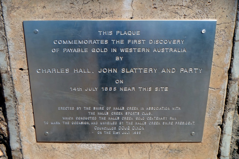
The Shire of Halls Creek covers an area of 143,030 Km2, most of which is sparsely populated. Halls Creek was the site of the first discovery of payable gold in Western Australia. For more information check out Shire of Halls Creek and Wikipedia.
| Phase | Name | Other Name/s |
|---|---|---|
| 5 | Fletcher’s Creek | Fletcher’s Creek Police Station Fletcher Creek |
| 3 | Old Halls Creek | Halls Creek 8 Elvire Creek Elvire Creek Police Station Black Elvire Black Elvire River Elvire River Old Elvire Elvire Gorge Saunders Creek, |
| Ruby Creek | 44 Gallon Drum Butchers Gully Mount Bradley Nuggetty Gully Palm Springs Rosie’s Corner Rosie’s Flat Ruby Plains Ruby Queen |
Wyndham-East Kimberley
The Shire of Wyndham-East Kimberley covers an area of 117,514 Km2 at Western Australia’s remote northeastern corner. For more information, check out Shire of Wyndham | East Kimberley and Wikipedia.
| Phase | Name | Other Name/s |
|---|---|---|
| 23 | 4 Mile | |
| 15 | Argyle Police Station | Wild Dog Police Station |
| 27 | Camden Harbour | The Camden Harbour Expedition Camden Harbour Government Camp |
| Denham River | Denham Station Dunham River Dunham River Police Station Dunham River Homestead |
Mid West
The Mid West is a sparsely populated region extending from the west coast of Western Australia, about 200 Km north and south of its administrative centre of Geraldton and inland to 450 Km east of Wiluna in the Gibson Desert.
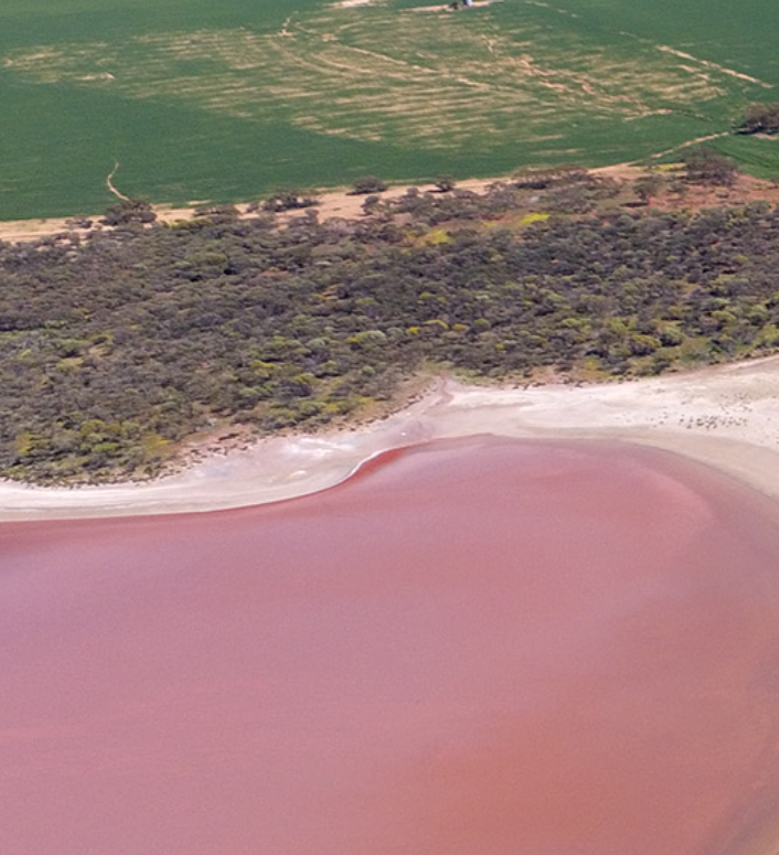
The Mid West has unique natural assets such as Kalbarri National Park, Abrolhos Islands, the Hutt Lagoon pink lake, wildflowers, dark skies and unique geologic formations. 9
To find out more about the Mid West region, visit Mid West Development Corporation and Wikipedia.
Carnamah
The Shire of Carnamah is about 310 kilometres north of Perth, the state capital, and about 181 Km south of the city of Geraldton. The Shire covers an area of 2,876 Km2. For more information visit Shire of Carnamah and Wikipedia.
| Phase | Name | Other Name/s |
|---|---|---|
| Five Gums | Five Gums Well | |
| 12 | Winchester |
Chapman Valley
The Shire of Chapman Valley is immediately northeast of the City of Geraldton and about 440 Km north of Perth. The Shire covers an area of 3,965 Km2 and its seat of government is the small town of Nabawa. For more information about Chapman Valley, check out Shire of Chapman Valley and Wikipedia.
| Phase | Name | Other Name/s |
|---|---|---|
| 9 | Nanson | Mount Erin Mt Erin Mount Erin Estate Mt Erin Estate Mt Erin Station |
| 26 | Naraling | |
| Narra Tarra | Narratarra Protheroe | |
| 7 | Yetna | Yetna Railway Siding |
Coorow
The Shire of Coorow is about 290 kilometres (180 mi) north of Perth, the state capital, and about 130 Km south of the city of Geraldton. The Shire covers an area of 4,194 Km2 and its seat of government is the town of Coorow, with the largest settlement being Leeman. For more information about Coorow, please see Shire of Coorow and Wikipedia.
| Phase | Name | Other Name/s |
|---|---|---|
| 15 | Gunyidi | Gunnyidi Siberia Fettlers Camp 132 Mile |
| 24 | Marchagee | |
| 13 | Waddy Forest | Waddi Forest |
Cue
The Shire of Cue is about 420 Km east-northeast of the port city of Geraldton and about 650 Km north-northeast of Perth. The Shire covers an area of 13,623 Km. You can learn more about Cue at Shire of Cue, A Complete Guide to Cue and Wikipedia.
As at 24 Oct 2025, there are 17 identified ghost towns in the Shire of Cue. The 17 towns share 29 other names that will also be researched as part of the project.
| Phase | Name | Other Name/s |
|---|---|---|
| 8 | Austin | Lake Austin The Island Lake Austin |
| 2 | Big Bell | Paton’s Find Coolardy Reef Coolardy Reward Little Bell Townsend Paton’s Coolardy Reward Coodardy Dutton’s Soak |
| 20 | Clinch Well 10 | Clinch’s Well Clinches Well |
| 23 | Cuddingwarra | Dead Finish Dead Fish |
| 11 | Cue | |
| 10 | Day Dawn | 4 Mile Four Mile Bundewadra |
| 6 | Garden Well | Gardner’s Well |
| Mainland | Mainland Well | |
| 21 | Milly Soak | Millie Soak |
| 21 | Mindoolah | Madoonga Station |
| 27 | Moyagee | Ned’s Well |
| 8 | Nallan | Nallan Railway Siding |
| 17 | Pinnacles | Pinnacles Well |
| 12 | Reedy | |
| 27 | Stake Well | Mummarra Baxter and Bray Timber Mill |
| 9 | Tuckanarra | Cork Tree Flat Boyds |
| Webb’s Patch |
Greater Geraldton
The City of Greater Geraldton is 424 Km north of Perth and includes the major WA port of Geraldton. It covers an area of 12,625 Km2. It was established on 1st July 2011 following the amalgamation of the Shire of Mullewa and the City of Geraldton-Greenough, that had been formed in 2007 by the amalgamation of the City of Geraldton and Shire of Greenough.
For more information visit City of Greater Geraldton and Wikipedia.
| Phase | Name | Other Name/s |
|---|---|---|
| 22 | Abrolhos Islands | Houtman Abrolhos |
| 9 | Ambania | |
| Beardie Pool | ||
| 4 | Bootenal | Boolungu Bootanoo Bootanu Bootenal Railway Siding |
| 24 | Bunbenoo | |
| 24 | Central Greenough | Greenough Greenough Flats 11 |
| 2 | Eradu | Greenough River |
| 19 | Grants | Grants Railway Siding Grant’s |
| 12 | Indarra | Indarra Railway Siding |
| 18 | Kojarena | Bringo Kojarena Railway Siding Bringo Railway Siding Newmarracarra Homestead |
| Leda | Leda Railway Siding | |
| 25 | Muddada Pool | Muddeda Pool |
| Narngulu | Narngulu Railway Siding Mullewa Junction Greenough Regional Prison | |
| Northern Gully | ||
| 11 | Pindar | Pindar Railway Siding |
| 16 | Tardun | Undatarra Wilroy Well |
| Wilroy | Onteru Onteru Spring Onterru Onterru Spring Onterro Onterro Spring Kockatea 2nd Site Kockatea 2 |
Irwin
The Shire of Irwin is in the Mid West region, about 50 km south of Geraldton and about 360 km north of Perth. The Shire covers an area of 2,374 km2, and its seat of government is the town of Dongara.
| Phase | Name | Other Name/s |
|---|---|---|
| 8 | Bookara | |
| Irwin | Irwin Inlet Irwin Springs Irwin River Irwin Hills | |
| 11 | Strawberry | Strawberry Railway Siding |
Meekatharra
Known to many as simply “Meeka”, the Shire of Meekatharra is about halfway between the town of Port Hedland and Perth. The Shire covers an area of 100,789 Km2. If you want to know more about the area, check Shire of Meekatharra and Wikipedia.
| Phase | Name | Other Name/s |
|---|---|---|
| 18 | Abbotts | Abbott’s Abbott’s Find |
| 7 | Burnakura | |
| 27 | Cashmans | Cashmans Bore Cashman’s Bore |
| 14 | Chesterfield | |
| Horseshoe | Horseshoe Bend The Shoe | |
| 4 | Gabanintha | |
| 17 | Gap Well | |
| 6 | Garden Gully | |
| 26 | Holdens | Holden’s Find Mikhaburra |
| Mount Gould | Mount Gould Police Station Mount Gould Station Mt Gould | |
| Mount Labouchere | Labouchere Mt Labouchere Mount Labouchere Police Station Labouchere Police Station Labouchere Well | |
| 16 | Nannine | Munarra Gully Travellers Rest Annean Lake Annean Nannine Police Station |
| 12 | Paroo | White Well |
| 15 | Peak Hill | |
| 13 | Quinns | |
| 19 | Star of the East | Star Porell |
| 9 | Yaloginda | 12 Mile Twelve Mile Twelve-Mile Sirdar Veins |
Mingenew

The Shire of Mingenew is about 110 Kms south east of Geraldton and about 370 Kms north of Perth. The Shire covers an area of 1,939 Km2. For more information visit Shire of Mingenew and Wikipedia.
| Phase | Name | Other Name/s |
|---|---|---|
| 5 | Yandanooka |
Morawa
The Shire of Morawa is about 170 kms east-southeast of the city of Geraldton and about 390 Kms north of Perth. The Shire covers an area of 3,516 Km2. For more information, please check out Shire of Morawa and Wikipedia.
| Phase | Name | Other Name/s |
|---|---|---|
| Canna | Pindawa | |
| 15 | Gutha | |
| 11 | Pintharuka | |
| 22 | Tilley Siding |
Mount Magnet
The Shire of Mount Magnet is about 570 Kms north-northeast of Perth. The Shire covers an area of 13,692 Km2. For more information see Shire of Mount Magnet and Wikipedia.
| Phase | Name | Other Name/s |
|---|---|---|
| 59 Mile 12 | ||
| 21 | Boogardie | |
| 17 | Lennonville | 8 Mile Eight Mile |
| 25 | Murrum | Munbinia Munbinnia Murrum Station |
| 8 | Paynesville | Paynton Fords East Mount Magnet |
| Pig Well | ||
| 10 | Poverty Flats | |
| 20 | Yoweragabbie |
Murchison
The Shire of Murchison is in the Mid West region. Including most of the Murchison and East Murchison goldfields, the shire is named after the Murchison River. It is Australia’s least-populated LGA and the only one without an official town. Five sparsely populated rural localities, and the shire includes 29 pastoral stations. For more information, please check out Shire of Murchison and Wikipedia.
| Phase | Name | Other Name/s |
|---|---|---|
| Beringara | Beringarra Beringara Police Station Beringarra Police Station |
Northampton
The Shire of Northampton is about 50 Kms north of Geraldton and about 460 Kms north of Perth. The Shire covers an area of 13,738 Km, and, while its seat of government is the town of Northampton, the largest settlement is Kalbarri. For more information, please see Shire of Northampton and Wikipedia.
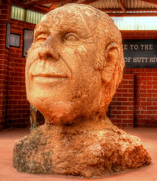
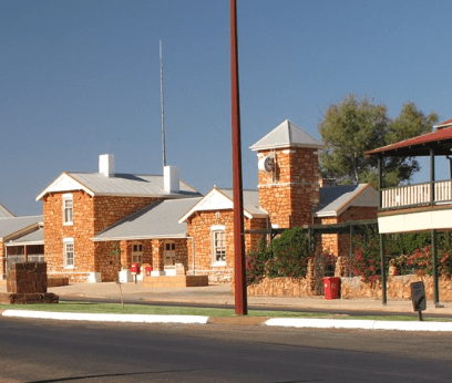
The shire of Northampton includes the former Principality of Hutt River, a now dissolved micronation which has no recognition by the state or federal governments.
“Prince” Leonard Casley died on 13 February 2019.13
| Phase | Name | Other Name/s |
|---|---|---|
| 19 | Ajana | |
| 3 | Galena | Geraldine Geraldine Mine Galena Bridge Surprise Surprise South |
| 20 | Lynton Convict Hiring Depot | Linton Convict Depot Lynton Homestead Sanford House |
| 16 | Norman’s Well | Norman’s Well Norman Well Mine Normans Well Mine |
| 5 | Ogilvie | Yuba Ogilivie |
| Port Gregory | Port Gregory Police Station Gregory Boat Harbour Pakington | |
| Shepherds Lode | Nana Taira Cu Mine | |
| Wanerenooka | Wanerenooka Police Station |
Perenjori
The Shire of Perenjori is about 360 Kms north of Perth. The Shire covers an area of 8,313 Km2. For more information, please check out Shire of Perenjori and Wikipedia.
| Phase | Name | Other Name/s |
|---|---|---|
| 25 | Bowgada | Chubble |
| 8 | Bunjil | Bundjil |
| 15 | Caron | |
| 25 | Koolanooka | |
| 26 | Maya | Pocanmaya |
| 3 | Rothsay | Bothsay Rothesay Woodley’s Find Woodleys Find |
| 7 | Warriedar |
Sandstone
The Shire of Sandstone is about 740 Kms northeast of Perth. The Shire covers an area of Km2, and you can find out more by visiting Shire of Sandstone and Wikipedia.
| Phase | Name | Other Name/s |
|---|---|---|
| 6 | 71 Mile Well | |
| 14 | Barrambie | |
| 18 | Birrigrin | 50 Mile Fifty Mile |
| 21 | Black Range | Nunngarra Nunngurra |
| 4 | Gums | The Gums |
| 10 | Hacks | Hacks Well Hack’s Well |
| 7 | Jonesville | Jonesville Bore Jones Find Swan Bitter Mine North End Mine |
| 26 | Maninga Marley | |
| 25 | Montague | |
| 9 | Range View | Bellchambers |
| Sandstone | Sandstone Brewery | |
| 8 | Two Mile | 2 Mile |
| 13 | Youanmi | Yuani Youani Coorang Youanne Youanme You-and-me You-and-I |
Three Springs
The Shire of Three Springs is about 310 Kms north of Perth. The Shire covers an area of 2,657 Km2, a Find out more about the area at Shire of Three Springs and Wikipedia.
The town’s name is derived from the three original water springs located to the north east of the town which were used by the early settlers and drovers for stock watering purposes.14
| Phase | Name | Other Name/s |
|---|---|---|
| 20 | Arrino | |
| 6 | Dudawa | Dudewa |
Wongan-Ballidu
| Phase | Name | Other Name/s |
|---|---|---|
| Damboring | Damboring Railway Siding | |
| Kondut |
Yalgoo
The Shire of Yalgoo is about 500 Kms north of Perth and covers an area of 28,215 Km2. For more information check out Shire of Yalgoo and Wikipedia.
| Phase | Name | Other Name/s |
|---|---|---|
| 15 | Beelene | Chain Pump |
| 11 | Carlaminda | Delaney’s Reef |
| 27 | Clinch Well | Clinch’s Well Clinches Well |
| 23 | Deep Well | Nannowtharra Narrowtharra The Brothers Deepwell |
| 24 | Ederga | |
| 2 | Field’s Find | Fields Find |
| 19 | Gnows Nest | Gnow’s Nest |
| 20 | Golden Grove | |
| 18 | Gullewa | Barnong Gullewa Mine |
| 10 | Joker | Bilberatha Notte’s Find |
| 13 | Messengers Patch | Messenger’s Patch |
| 7 | Ninghan | Ninghan Station Pinyalling Mount Pinyalling Mt Pinyalling Pingaling Pingalling Grey County Mount Singleton Lake Moore |
| Noongal | Melville Square Well (? – see Square Well in Phase 25) | |
| 6 | Paynes | Payne’s Find |
| 21 | Pindathuna | |
| 25 | Square Well | |
| 21 | Teindewa | Kockatea No.1 55 Mile Railway Siding |
| 14 | Wadgingarra | |
| 26 | Woolgerong | |
| 27 | Wuraga | Wuraga Dam Wuraga Railway Siding |
| 22 | Yuin |
Peel
The Peel region is located on the west coast of Western Australia, about 75 Kms south of Perth. It consists of the City of Mandurah, and the Shires of Boddington, Murray, Serpentine-Jarrahdale and Waroona. The economy of the Peel region is dominated by mining and mineral processing including bauxite, gold and mineral sands. It includes an aluminium refinery. 15
Boddington
The Shire of Boddington is about 120 Kms south-east of Perth. The Shire covers an area of 1,901 Km2 and you can find out more at Shire of Boddington and Wikipedia.
| Phase | Name | Other Name/s |
|---|---|---|
| 26 | Maradong | |
| 16 | Wuraming | Campbell |
Murray
The Shire of Murray is has an area of 1,710.1 Km2 and is 80 Kms south of Perth. The Shire is centred on the town of Pinjarra, one of the oldest towns in Western Australia where a number of 19th-century mud brick buildings are still in use today.
For more information see Shire of Murray and Wikipedia.
| Phase | Name | Other Name/s |
|---|---|---|
| 22 | Amphion | Amphion Railway Siding Amphion Timber Mill |
| 10 | Banksiadale | |
| Duncan’s Timber Mill | ||
| 13 | Holyoake | Holyoake Timber Mill |
| 21 | Hotham Timber Mill | Hotham River Scheme |
| 18 | Huntly | Huntley Huntly Settlement Myara |
| 12 | Inglehope | |
| Marrinup | Marrinup No.16 Marrinup POW Camp | |
| 7 | P. W. D. Timber Mill | |
| 2 | Pindalup | Vincent Vincent Railway Siding Pindalup Ports No 1 Timber Mill Pindalup Ports No 2 Timber Mill Pindalup Railway Siding Pindalup Ports |
| 4 | Plavins | Plavins Timber Mill Plavins Railway Siding |
| 9 | Tullis | |
| 17 | Whittakers Timber Mill |
Serpentine-Jarradale
The Shire of Serpentine-Jarrahdale is south east of Perth and has an area of 905 Km2. For more information, please read Shire of Serpentine-Jarradale and Wikipedia.
| Phase | Name | Other Name/s |
|---|---|---|
| 8 | Burnbrae Presbyterian Children’s Home |
Waroona
The Shire of Waroona is between Mandurah and Harvey and about 110 Kms south of Perth. The Shire covers an area of about 835 km2 . You can find out more at Shire of Waroona and Wikipedia.
| Phase | Name | Other Name/s |
|---|---|---|
| 16 | 11 Mile | 11 Mile Timber Mill 11 Mile School |
| 21 | Nanga | |
| 6 | Wagerup | Waigerup Waigeerup Wagerup Police Station |
| 14 | Waterous | Waterous Mill |
Perth
Most of the Perth Metropolitan Region is outside the scope of this project. However there are just a few places that do fall within the project’s definition of a ghost community.
Kalamunda
The City of Kalamunda is in Perth’s eastern metropolitan region, about 25 Kms east of the Perth CBD. The area covers 324 Km2, much of which is state forest rising into the Darling Scarp. For more information see City of Kalamunda and Wikipedia.
Photo of Barton’s Mill from Pickering Brook Heritage Group Ince.16
| Phase | Name | Other Name/s |
|---|---|---|
| 23 | Barton’s Mill | Barton’s Mill Prison |
| 11 | Canning Mills | |
| 12 | Carilla | Beamulla |
| 3 | Carinyah | Carinyah Forestry Settlement |
| 7 | Mason and Bird Timber Mill | Mason’s Mill The Hills Station |
| 8 | Smailes Mill | |
| Smith’s Mill | ||
| Weston’s Mill |
Mundaring
The Shire of Mundaring is located in the Perth metropolitan region and covers an area of 645 Km2. If you want to know more check out Shire of Mundaring and Wikipedia.
| Phase | Name | Other Name/s |
|---|---|---|
| Dyke’s Timber Mill | Dyke’s Lumber Mill Dykes Mill | |
| 20 | Lion Timber Mill | |
| 7 | Mundaring Weir | No. 1 Pumping Station Goldfields Weir Hotel Travellers Inn Horton’s Half-way House Lakes Road-house Travellers Rest |
| 12 | No.2 Pumping Station | Sawyers Valley |
Pilbara
Radiocarbon dating estimates in evidence show that rock art and standing stones at Murujuga in the Dampier Archipelago, Australia’s earliest known stone structures, [believed to date] from 6046 to 5338 BC, are of contextualization [of] thousands of years of unique cultural traditions.
Ashburton
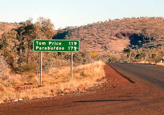
The Shire of Ashburton covers an area of 105,647 Km2. It is named after the Ashburton River. The shire’s administration centre is in the town of Tom Price. For more information, visit Shire of Ashburton and Wikipedia.
| Phase | Name | Other Name/s |
|---|---|---|
| 19 | Coorara Claypan | |
| 26 | Dead Finish 18 | |
| Mount Mortimer | Mt Mortimer Mortimer Bore | |
| 6 | Old Onslow | Onslow (pre 1926) |
| 25 | Wittenoom |
East Pilbara
The Shire of East Pilbara covers an area of 372,571 Km2, larger than the states of Victoria and Tasmania combined. The Shire’s seat of government, and home to nearly half the Shire’s population, is the town of Newman in the shire’s south-west. For more information, go to Shire of East Pilbara and Wikipedia.
| Phase | Name | Other Name/s |
|---|---|---|
| 8 | Bamboo | Bamboo Creek |
| 17 | Cooglegong | |
| 25 | Coongan | Coongan Railway Siding Talga Talga |
| 6 | Corunna Downs | Corunna Downs Station Corunna Downs Airbase Corunna Downs Airfield |
| Golden Gate | ||
| Goldsworthy | ||
| 26 | Moolyella | |
| 27 | Poondino | |
| Roy Hill | Roy Hill Station Christmas Creek Mine Cloud Break Mine Mount Lewin Mount Nicholas Roy Hill Mine | |
| Shay Gap |
Karratha
The City of Karratha, in the Pilbara region, covers an area of 15,882 Km2 and had a population of 22,199 in the 2021 census.19 For more information check out City of Karratha and Wikipedia.
| Phase | Name | Other Name/s |
|---|---|---|
| 22 | Andover | Old Woodbrook Andover Station |
| 24 | Balla Balla | Ballaballa |
| 14 | Barrow Island | |
| 1 | Cossack | TienTsin Bajinhurrba Butcher’s Inlet Bungaran Lazarette Jarman Island |
| 13 | Delambre Island | |
| 22 | Enderby Island | |
| 26 | Hearson Cove | |
| 11 | Mallina | Mallina Police Station Malina |
| 20 | Sherlock Station | |
| 21 | Whim Creek |
Port Hedland
The Town of Port Hedland is includes the settlements of Port Hedland and South Hedland and the industrial precinct of Wedgefield. Very few of its 15,684 residents live outside of these settlements. For more information visit Town of Port Hedland and Wikipedia.
| Phase | Name | Other Name/s |
|---|---|---|
| 18 | Condon | Shellborough |
| 6 | De Grey | De Grey Police Station De Grey Homestead DeGrey |
| 19 | Egina | Egina Well |
| 4 | Pilbarra | Pilbarra Creek Pilbarra Pool Yandeyarra Hotel Yule River |
| Station Peak | Station Peak Police Station Station Peak Gold Mine | |
| 12 | Talga Talga | Tilga Tilga |
South West
The South West region has an area of 23,970 Km2 and has a diverse economy ranging from mineral sands to viticulture to wine. It is the most popular tourist destination in WA after Perth. You can learn more about the south west at South West Life and Wikipedia.
Augusta-Margaret River
The Shire of Augusta Margaret River is about 270 Kms south of Perth. The shire covers an area of 2,243 Km2 and for more information check out Shire of Augusta Margaret River and Wikipedia.
| Phase | Name | Other Name/s |
|---|---|---|
| 24 | Boranup | Dianella |
| 23 | East Witchcliffe | Group Settlement 57 Group 57 Narawary Narrawary Walgine |
| 11 | Jarrahdene Timber Mill 20 | |
| 7 | Kudardup | Coodardup Kudardup Mill Coodardup Caves |
| 16 | Nillup | |
| 10 | Preston No.2 Timber Mill |
Boyup Brook
The Shire of Boyup Brook is about 270 Kms southeast of Perth and you can find out all about it at Shire of Boyup Brook and Wikipedia.
The shire’s name is derived from the Aboriginal word Booyup, meaning “Place of Big Smoke”, referring to the smoke from the burning of grasstrees, or “Place of Big Stones”, in reference to the large granite rocks surrounding the Upper Blackwood area. 21
| Phase | Name | Other Name/s |
|---|---|---|
| 3 | Dinninup | Dinninup Vale Dinningup |
| 24 | Vincent Timber Mill 22 | |
| 11 | Wilga | Wilga Railway Siding Wilga Timber Mill |
| 2 | Woop Woop | Woop Woop Timber Mill Woop-Woop |
Bridgetown-Greenbushes
The Shire of Bridgetown–Greenbushes is about 80 Kms southeast of Bunbury and about 260 Kms south of Perth. For more information about the area check out Shire of Bridgetown-Greenbushes and Wikipedia.
| Phase | Name | Other Name/s |
|---|---|---|
| 19 | Blackwood Police Station | Blackwood Bridge Police Station Blackwood No.1 Police Station Geegelup Police Station |
| 3 | Brown’s Mill | |
| 13 | Catterick | |
| 12 | Hester | Hester Brook Dalgarup Dalgarup Brook |
| 24 | Moojebing | |
| 25 | North Greenbushes | |
| 14 | South Greenbushes | South Bunbury Bunbury End |
| Timber Corporation Timber Mill – Greenbushes | ||
| 8 | Yornup |
Bunbury
The City of Bunbury is in the South West region covering an area of about 66 Km2 along the coast about 180Km south of Perth and has a population of 32,000.
| Phase | Name | Other Name/s |
|---|---|---|
| 23 | Abba River |
Busselton
The City of Busselton is in the South West region about 230 km south of Perth. The city covers an area of 1,455 km2 and had a population of 40,640 in 2021.
| Phase | Name | Other Name/s |
|---|---|---|
| 9 | Jindong | Lennox Group Settlement 57 Group 57 |
| 16 | Lockeville | Lockeville Timber Mill Ballarat Lockville |
| 6 | Quilerup | |
| 15 | Quindalup Timber Mills | |
| 23 | Sussex Timber Mill |
Capel
| Phase | Name | Other Name/s |
|---|---|---|
| 3 | Ludlow | Ludlow Bridge Ludlow Forestry Mill Ludlow Forestry Settlement North Ludlow |
| 27 | Wright Timber Mill | Wright’s Timber Mill |
Collie
| Phase | Name | Other Name/s |
|---|---|---|
| 5 | Beela Railway Siding | Bila Railway Siding |
| Buckingham | Muja Open Cut Coal Mine Cabbage Tree Hotel Buckingham Mill | |
| 24 | Fernbrook Railway Siding | Lunenburg Railway Siding |
| 8 | Lewis & Reid Timber Mills | Lewis & Reid Timber Mills Forward Camp |
| Lucknow timber Mill | ||
| 14 | Lyalls Mill | Lyall’s Timber Mill Lyell’s Timber Mill Lyall Mill Lyall |
| Millbrook | Millbrook Railway Siding Upper Millbrook | |
| Port’s No.1 Timber Mill | ||
| Port’s No.3 Timber Mill | ||
| 12 | Sexton & Drysdale Timber Mill | |
| 18 | Shotts | Benelaking |
| 10 | Worsley Timber Mill |
Dardanup
| Phase | Name | Other Name/s |
|---|---|---|
| 13 | Wellington Mills | Wellington Timber Mills |
Donnybrook-Balingup
| Phase | Name | Other Name/s |
|---|---|---|
| 22 | Argyle | Argyle Timber Mill |
| 27 | Baxter & Prince Timber Mill | Baxter & Prince No.1 Timber Mill |
| 2 | Ferguson Timber Mills 23 | Ferguson Timber Mill – Lowden Ferguson Timber Mill – Yarloop |
| 1 | Goodwood | Goodwood Timber Mill |
| 5 | Grimwade | East Kirup Timber Mill East Kirup |
| Harrington Timber Mill | ||
| 6 | Hedge’s Timber Mill | |
| 8 | Newlands | Newlands Railway Siding |
| Port’s No.2 Timber Mill | ||
| Quongup | Quongup Brook Quongup Falls Quongup Mill |
Harvey
| Phase | Name | Other Name/s |
|---|---|---|
| 5 | Asquith Timber Log Falling Camp | Asquith Asquith Concession Asquith Bridge Long Gully Bridge |
| Belvidere | Belvedere Bellevedere Hudson’s Grant | |
| 2 | Ferguson Timber Mills 24 | Ferguson Timber Mill – Lowden Ferguson Timber Mill – Yarloop |
| 18 | Hakea | |
| Hoffman Timber Mills | New Hoffman Hoffman No.1 Timber Mill Hoffman, No.2 Timber Mill | |
| 17 | Klondyke Timber Mill | |
| Miellup | Myalup Myalup Timber Mill Myalup Pines | |
| Mornington | Camp Mornington Millars Karri and Jarrah Forests Morning Timber Mill Mornington Mills Mornington Station | |
| 27 | Stonehouse Camp | |
| 15 | Tallanalla | |
| 26 | Treesville | Treesville Timber Mill Treesville Mill |
| 14 | Willowdale | Willowdale Forests Department Settlement |
| 19 | Yarloop No.5 Timber Mill |
Manjimup
| Phase | Name | Other Name/s |
|---|---|---|
| Jardee | Jarnadup | |
| 6 | Shannon | Shannon River Mill |
Merredin
| Phase | Name | Other Name/s |
|---|---|---|
| 2 | Goomarin |
Nannup
| Phase | Name | Other Name/s |
|---|---|---|
| 26 | Barrabup Timber Mill | |
| Claymore | Swan Timber Mill Swan Saw Mill Claymore Timber Mill Claymore Railway Siding | |
| 17 | Dellerton Railway Siding | |
| 19 | Donnelly River Timber Mill | Donnelly River Village |
| 23 | Ellis Creek | Ellis Creek Timber Mill |
Pingelly
| Phase | Name | Other Name/s |
|---|---|---|
| Stanton Springs | Stanton Springs Police Station Staunton Springs |
Wheatbelt
Beverley
| Phase | Name | Other Name/s |
|---|---|---|
| 7 | Mount Kokeby | Kokeby Mt Kokeby |
Brookton
| Phase | Name | Other Name/s |
|---|---|---|
| 11 | Aldersyde | |
| 14 | Kweda |
Bruce Rock
| Phase | Name | Other Name/s |
|---|---|---|
| 20 | Ardath | Kerkerin |
| 25 | Belka | Totadgin Ulva Ulva Siding |
| 23 | Kwolyin | Koarin |
Chittering
The Shire of Chittering is in the Wheatbelt region, covering an area of about 1,200 square kilometres just beyond the northern edge of the Perth metropolitan area. Its seat of government is the town of Bindoon. If you want to know more check out Shire of Chitting and Wikipedia.
| Phase | Name | Other Name/s |
|---|---|---|
| Mooliabeenee25 | Mooliabeenie Mooliabeenee Railway Siding Mooliabeenee Hill |
Corrigin
| Phase | Name | Other Name/s |
|---|---|---|
| 22 | Bilbarin | Wogerlin |
| 9 | Bullaring | |
| 13 | Bulyee | Bulyee Railway Siding |
| 17 | Gorge Rock | |
| 20 | Jubuk | Jubuk Well Jubuk Siding |
| Kunjin | Kunjinn Railway Siding Kunjin Kunjin Railway Siding | |
| 21 | Lomos | Lomas |
| 24 | Mears | |
| 15 | Nyala | |
| Weam | Weam Railway Siding |
Cuballing
| Phase | Name | Other Name/s |
|---|---|---|
| 3 | Aldinga | Stratherne Strathearn |
| 18 | Yornaning | Yornan Siding Yornanmunging Yernanunging Water Tank |
Cunderdin
| Phase | Name | Other Name/s |
|---|---|---|
| 27 | No.3 Pumping Station | Cunderdin |
| 17 | Youdegin |
Dalwallinu
| Phase | Name | Other Name/s |
|---|---|---|
| 22 | Buntine | Buntine Police Station |
| 4 | Jibberding | |
| 5 | Mia Moon | Miamoon Mia-moon |
| 1 | Nugadong | |
| 8 | Xantippe |
Dandaragan
| Phase | Name | Other Name/s |
|---|---|---|
| Dandaragan | Dandaragan Police Station |
Dowerin
| Phase | Name | Other Name/s |
|---|---|---|
| 8 | Amery | Amery Railway Siding Ejanding |
| 2 | Dowerin Lakes | Old Dowerin |
| 5 | Minnivale | Nenin 36 Mile Post of the Rabbit Proof Fence |
Dumbleyung
| Phase | Name | Other Name/s |
|---|---|---|
| 14 | Bullock Hills | |
| 6 | Candlelight | Candlelight Siding Candlelight Soak Tub Soak |
| 19 | Coomelberrup | Coomelberrup Lake |
| 20 | Datatine | |
| 18 | Dongolocking | |
| 17 | Kilburn | |
| 10 | Kukerin | North Kukerin |
| 5 | Merilup | Merilup Brook |
| 25 | Moulyinning | |
| 7 | Nairibin | Brambrae School Nairibin Soak Nairibin Rock |
| 9 | Nippering | North Nippering |
| 4 | Pingarning | |
| 24 | Tarin Rock | |
| 13 | Wishbone | Coarring Mount Pleasant Mt Pleasant |
Kellerberrin
| Phase | Name | Other Name/s |
|---|---|---|
| 6 | Baandee | Lake Baandee Bandee Baandui Barndi Barndy |
| Hines Hill | ||
| 11 | Nangeenan | Bainding |
Kent
| Phase | Name | Other Name/s |
|---|---|---|
| Nola | Nola Railway Siding |
Koorda
| Phase | Name | Other Name/s |
|---|---|---|
| 24 | Kulja | |
| 24 | Mollerin |
Kulin
| Phase | Name | Other Name/s |
|---|---|---|
| 4 | Jitarning | Geetaring |
Lake Grace
| Phase | Name | Other Name/s |
|---|---|---|
| 10 | Buniche | Buniche Dam |
| 17 | Lake Biddy |
Merredin
| Phase | Name | Other Name/s |
|---|---|---|
| 8 | Gilgai | No. 7 Pumping Station |
| 25 | No.4 Pumping Station | Merredin |
Moora
| Phase | Name | Other Name/s |
|---|---|---|
| Round Hill | Nardy Nardie |
Mount Marshall
| Phase | Name | Other Name/s |
|---|---|---|
| 21 | Welbungin | Polkingholme’s Corner Welbunging |
| Wialki | Datjoin |
Mukinbudin
| Phase | Name | Other Name/s |
|---|---|---|
| 10 | Bonnie Rock | Bonny Rock |
| Lake Brown | Kalkalling | |
| 27 | Wilgoyne |
Narrembeen
| Phase | Name | Other Name/s |
|---|---|---|
| 22 | Emu Hill | |
| South Kumminin | Arrowsmith |
Narrogin
| Phase | Name | Other Name/s |
|---|---|---|
| 5 | Noman’s Lake | Nomans Lake |
Northam
| Phase | Name | Other Name/s |
|---|---|---|
| 26 | Irishtown | Irish Town |
| Koojedda | Kojedda South Koojedda 45 ¼ mile crossing |
Nungarin
| Phase | Name | Other Name/s |
|---|---|---|
| 25 | Campion | |
| 22 | Chandler | |
| 5 | Kwelkan | Quelcan Well |
| 7 | Mangowine | Mangowine Well Mangowine Inn Mangowine Primary School |
| 21 | North Nungarin |
Pingelly
| Phase | Name | Other Name/s |
|---|---|---|
| 3 | Dattening | Taylor’s Well Taylors Well |
| 26 | Kulyalling | Kylaling Westbrook Railway Siding |
| 20 | Mourambine |
Quairading
The Shire of Quairading is about 170 Kms east of the state capital, Perth. The Shire covers an area of 2,018 Km2. for more information check out Shire of Quairading and Wikipedia.
| Phase | Name | Other Name/s |
|---|---|---|
| 8 | Balkuling | Balkulling |
| Jacob’s Well | Jacobs Well Jacob’s Siding | |
| Pantapin | Ulakain Pantapin Railway Siding |
Tammin
The Shire of Tammin is about 80 Kms west of Merredin and about 180 Kms east of Perth, Tammin is one of the least populous local government areas in Western Australia with only 386 people recorded in the 2021 Census26. For more information visit Shire of Tammin and Wikipedia.
Toodyay
The Shire of Toodyay is located on the north-eastern limits of the Perth metropolitan area. The Shire covers an area of 1,694 Km2. For more detailed information about the Shire, go to Shire of Toodyay and Wikipedia.
| Phase | Name | Other Name/s |
|---|---|---|
| Baylup | Bailup Baylup Police Station Bailup Police Station | |
| 6 | Culham | |
| 14 | Jimperding | Jumperding Timperding |
Trayning
The Shire of Trayning is about 60 Kms northwest of Merredin and about 240 Kms east of Perth. The Shire covers an area of 1,651 Km2. For more information check out Shire of Trayning and Wikipedia.
| Phase | Name | Other Name/s |
|---|---|---|
| 4 | Kodj Kodjin | North Baandee |
| 23 | Korrelocking | |
| 11 | Yelbeni | Yelbene Yelbini |
Victoria Plains
The Shire of Victoria Plains is about 160 Kms north of Perth. It covers an area of 2,569 Km2, and its seat of government is the town of Calingiri. More information can be found at Shire of Victoria Plains and Wikipedia.
| Phase | Name | Other Name/s |
|---|---|---|
| 12 | Gillingarra | |
| 5 | Mogumber | Moore River Native Settlement Mogumber Native Settlement |
| 7 | Wyening | |
| 20 | Yerecoin |
Wagin
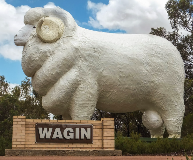
The Shire of Wagin is about 230 Kms southeast of Perth. The Shire covers an area of about 1,948 Km2, and to find out more go to Shire of Wagin and Wikipedia.
| Phase | Name | Other Name/s |
|---|---|---|
| 5 | Piesseville | Buchanan Buchanan River Barton Piesse |
Wandering
The Shire of Wandering is a local government area in the Wheatbelt region , and, with a population of 444 as at the 2016 census, is one of the nation’s smallest. It covers an area of 1,901 Km2 to the east of Albany Highway about 120 Kmx south-east of Perth. For more information check out Shire of Wandering and Wikipedia.
| Phase | Name | Other Name/s |
|---|---|---|
| 14 | 36 Mile Police Station | |
| 19 | Gleneagle | Glen Eagle |
| 2 | Neta Vale | Neta Vale Telegraph Station Neta Vale Homestead |
West Arthur
The Shire of West Arthur is west of Albany Highway about 200 Kms south-east of Perth. The Shire covers an area of 2,834 Km2. For find out more, check Shire of West Arthur and Wikipedia.

| Phase | Name | Other Name/s |
|---|---|---|
| Arthur River | Arthur River Police Station 125 Mile Mount Pleasant Inn Mt Pleasant Inn The Arthur | |
| 21 | Bowelling | |
| Woagin | 131 Mile 131 Mile Police Station |
Westonia
The Shire of Westonia is in the eastern Wheatbelt region of Western Australia, about 310 Kms east of Perth,
Although the Shire of Westonia is located in the Wheatbelt region, it is at the eastern limit of land suitable for wheat growing. The most important industries of Westonia today are wheat and sheep, but historically it was a gold mining area. 28
For more information, check out Shire of Westonia and Wikipedia.
| Phase | Name | Other Name/s |
|---|---|---|
| 19 | Boodarockin | Boodarockin Railway Station |
| Egg Rock | Egg Rock Tank Egg Rock Runnoff | |
| 5 | Walgoolan | |
| 14 | Warralakin | Warralakin Railway Siding Geelakin Gelacki |
Wickepin
The Shire of Wickepin is east of Narrogin and about 220 Kms southeast of Perth. The Shire covers an area of 2,042 Km2. For more information refer to Shire of Wickepin and Wikipedia.
| Phase | Name | Other Name/s |
|---|---|---|
| 16 | Toolibin | |
| 22 | Wogolin |
Williams
| Phase | Name | Other Name/s |
|---|---|---|
| Bannister | Bannister Police Station Halfway House | |
| Crossman | Crossman Railway Siding | |
| North Bannister | Threeways Roadhouse |
Wongan-Ballidu
On 10 February 1887, the Melbourne Road District was created. It was renamed the Wongan-Ballidu Road District on 18 June 1926, and, on 1 July 1961, it became a shire following the passage of the Local Government Act 1960. It is about 180 Kms NNE of Perth. For more information, see Shire of Wongan-Ballidu and Wikipedia.
| Phase | Name | Other Name/s |
|---|---|---|
| 26 | Burakin |
Wyalkatchem
The Shire of Wyalkatchem is located in the Wheatbelt and its seat of government is the town of Wyalkatchem, about 190 Kms northeast of Perth. To find out more, look at Shire of Wyalkatchem and Wikipedia.
| Phase | Name | Other Name/s |
|---|---|---|
| 26 | Benjaberring | Benjabberring Benjabbering |
| 23 | Cowcowing | |
| 3 | Debdebin | Derdebin |
| 3 | Nalkain | Nalkain Railway Siding |
| 19 | Nembudding | Homebush Siding |
Yilgarn
The Shire of Yilgarn is about 400 Km east of Perth. The Shire covers an area of 30,720 Km2 and its main industries are mining and farming. For more information, check out Shire of Yilgarn and Wikipedia.
| Phase | Name | Other Name/s |
|---|---|---|
| 18 | Bodallin | Boddallin Boddalin Bodalin |
| 22 | Bullfinch | |
| 6 | Burbidge | |
| 22 | Dedari | No.8 Pumping Station |
| Ennuin | Eenuin Eenvin | |
| 2 | Ghooli | No. 6 Pumping Station Ghouli |
| 7 | Golden Valley | Knutsford Colreavy |
| 23 | Hollerton | |
| 17 | Karalee | Karalee Railway Siding Karalee Reservoir Karalee Dam Karalee Rocks |
| 13 | Koolyanobbing | |
| 9 | Lake Deborah | |
| 6 | Mount Jackson | Mt Jackson Mount Jackson Homestead |
| 26 | Mount Palmer | Mt Palmer Palmer’s Find |
| 21 | Parker’s Range | Parkers Range |
| 12 | Yellodine | Yellowdine Railway Siding Duladgin Yelladine Reen’s Soak |
| 16 | Yerbillon | No.5 Pumping Station |
York
The Shire of York covers an area of 2,133 Km2 and is just beyond the eastern fringe of Perth’s metropolitan area. To find out more about the Shire, go to Shire of York and Wikipedia.
| Phase | Name | Other Name/s |
|---|---|---|
| 23 | Auburn | Auburn Cottage Auburn North Auburn Pool |
| 24 | Avondale | Avondale Park |
| 9 | Greenhills | Green Hills |
| 20 | Gwambygine |
Region/LGA Unknown
The following communities are still in the process of being formally researched and scheduled. As their details are added they will move into their correct locations in this list.
In our most recent update, we located all 28 places on our original list, but have now added 6 new places that need further research. If you can help us, please drop us an email via our contact page.
| Phase | Name | Other Name/s |
|---|---|---|
| Canning | Canning Police Station | |
| Dean | ||
| Goldfields Police Station | ||
| Lake Matilda Police Station29 | ||
| Midway Police Station | Midway Bore Midway Well | |
| Prowacka | ||
| Table Hills | Table Hills Police Station | |
| Thomas | Thomas Police Station |
Sources and Notes
- Wikipedia, 2025. City of Kalgoorlie Boulder. Retrieved 7 Apr 2025 from https://en.wikipedia.org/wiki/City_of_Kalgoorlie%E2%80%93Boulder ↩︎
- For Smithfield #2, see Moondine ↩︎
- When the town of Laverton was founded it was near to, but not on the site of, the original settlement of British Flag. ↩︎
- FHWA, 2025. Kundip Dreaming. Retrieved 8 Apr 2025 from https://ghostswa.au/2025/03/11/kundip-dreaming/ ↩︎
- City of Albany, 2025. Albany 2026. Retrieved 8 Apr 2025 from https://www.albany.wa.gov.au/facilities/events/albany-bicentenary-2026.aspx ↩︎
- Shire of Woodanilling, 2025. History. Retrieved 8 Apr 2025 from https://www.woodanilling.wa.gov.au/discover/about-woodanilling/history.aspx ↩︎
- Kimberley Experiences. Retrieved 9 Apr 2025 from https://www.kimberleyexperiences.com.au/the-kimberley/ ↩︎
- In 1948 an airfield was built near the site of the present town of Halls Creek and over the next decade the old town moved nearer to this new site. Except for the police station, which was finally relocated in 1961, the old town was abandoned by 1954. Prior to the move Old Halls Creek was known as Halls Creek. ↩︎
- Mid West Development Commission, 2025. Mid West Advantages. Retrieved from https://www.mwdc.wa.gov.au/regional-advantages.aspx on 15 Apr 2025 ↩︎
- Clinch Well in Cue (there are a number of communities called Clinch Well – see Yalgoo). ↩︎
- NOT Greenough River because Greenough River is also known as Eradu! ↩︎
- 59 Mile is located between Sandstone and Mount Magnet, so may actually be in the Shire of Sandstone. If you are reading this, can you help to locate 59 Mile accurately? ↩︎
- Wikipedia, 2025. Principality of Hutt River. Retrieved on 25 Apr 2025 from https://en.wikipedia.org/wiki/Principality_of_Hutt_River ↩︎
- Three Springs Shire Council, 2025. District Highlights. Retrieved on 25 Apr 2025 from https://www.threesprings.wa.gov.au/index.php/visitors ↩︎
- Wikipedia, 2025. Peel (Western Australia). Retrieved on 25 Apr 2025 from https://en.wikipedia.org/wiki/Peel_(Western_Australia) ↩︎
- Barton’s Mill retrieved on 15 Jul 2025 from https://pickeringbrookheritagegroup.com.au/heritage/registered-site/ ↩︎
- Wikipedia, 2025. Pilbara. Retrieved on 20 Apr 2025 from https://en.wikipedia.org/wiki/Pilbara ↩︎
- See also, Cudingwarra in the Shire of Cue ↩︎
- Australian Bureau of Statistics, 2022. Karratha 2021 Census All Persons QuickStats. Retrieved on 30 Apr 2025 from https://www.abs.gov.au/census/find-census-data/quickstats/2021/LGA54310 ↩︎
- In the Karridale area. ↩︎
- Shire of Boyup Brook, 2025. History. Retrieved 30 Apr 2025 from https://www.boyupbrook.wa.gov.au/community/about-the-shire/history.aspx ↩︎
- In the Benjinup area ↩︎
- Also in Shire of Harvey ↩︎
- Also in Shire of Donnybrook-Balingup ↩︎
- While Mooliabeenee is primarily known as a homestead, the project has included it in our list due to its previous incarnations as a railway siding and military site. ↩︎
- Australian Bureau of Statistics, 2021. “Tammin (Local Government Area)”. Australian Census 2021 QuickStats. Retrieved 20 Apr 2025 from https://www.abs.gov.au/census/find-census-data/quickstats/2021/LGA58190.
↩︎ - North Tammin is now a locality in the Shire of Tammin. ↩︎
- Wikipedia, 2025. Shire of Westonia. Retrieved 19 Apr 2025 from https://en.wikipedia.org/wiki/Shire_of_Westonia ↩︎
- There are more than one Lake Matilda in WA – one in the Shire of Wiluna and the other in the Shire of Plantaganet. Need to find out exactly where the Lake Matilda Police Station was located. ↩︎
